Cooler Friday turns warmer Saturday then colder Saturday night (+4 Maps)
6/06/2019 10:52pm

> From the WeatherWatch archives
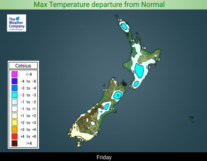
There may be a southerly change spreading over the country today but many regions are still around average for early June, showing you how much warmer than usual conditions have been so far this year.
Even with the south to south west change today, many areas on Saturday will be average to warmer than average thanks to the windy conditions pushing temperatures up inland and to the east.
The North Island looks especially mild on Saturday despite the south west flow. But when you track the origins of the SW wind flow you can see that the air is actually moving in to New Zealand from the central part of Australia, so it’s not as cold as you might think.
But, once those winds fade out on Saturday evening and high pressure moves in, the long dark night will make it much colder. The overnight lows on Saturday night/Sunday morning will be below normal in a number of places with some frosts possible inland.


– WeatherWatch.co.nz
Latest Video

Wintry burst of weather: Snow, squally showers then sunshine & frosts
A polar change (another one!) arrives on Friday for the South Island and goes nationwide on Saturday, leaving NZ under…
Related Articles
Wintry burst of weather: Snow, squally showers then sunshine & frosts
A polar change (another one!) arrives on Friday for the South Island and goes nationwide on Saturday, leaving NZ under…

Antarctic southerly for parts of NZ Fri & Sat
For the first time this year a southerly from off Antarctica is heading towards the South Island, followed by more…

Meteors – Your Eyewitness Reports!
WeatherWatch.co.nz receives meteor reports from all over New Zealand and the globe, 24/7/365. **CASUAL COMMENTS**If you’ve seen something in the…

