Colder nights for some this week but warmer than average days for many (+6 Maps)
21/07/2019 8:29pm

> From the WeatherWatch archives
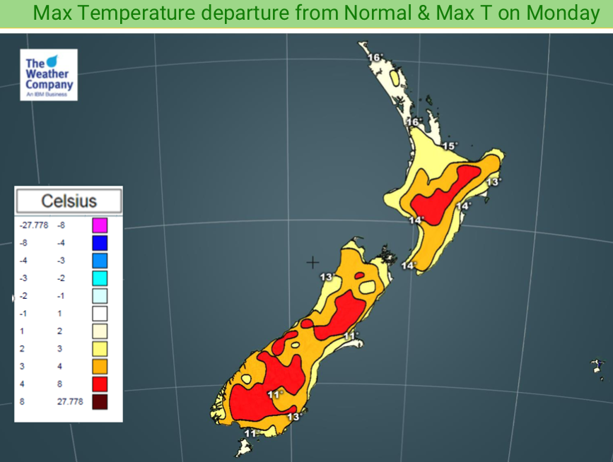
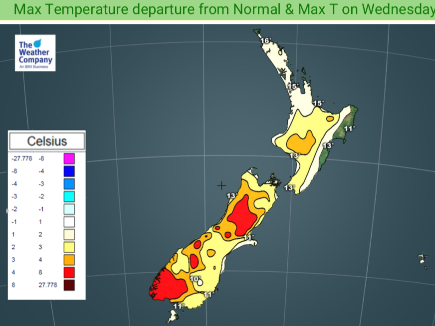
We have colder nights this week compared to last week but daytime highs are as much as several degrees above normal for late July.
The shortest day of the year was over a month ago which means New Zealand is now in the depths of winter temperature-wise. The coldest days and nights of the year are typically between now and mid August. The opposite to this time of year is mid January to mid February, usually the hottest point of the year so we are exactly 6 months from then in what should be now the coldest point. But it’s not that cold but on historical temperatures.
Monday, Tuesday and Wednesday all have daytime highs well above normal, as much as a couple degrees to 8 degrees above where we should be now. So this week will be a positive one for pasture growth, mowing lawns and hanging out laundry. (although some rain moves into the eastern North Island from the east around mid week).
But we do have a bit of a balancing act with light winds and clearer skies producing colder than normal nights in about half of the country. The North Island in particular will have some colder than average nights coming up, with some regions a couple to several degrees colder than normal. However the frosts that we normally see in late July look very isolated this week.
With the world just passing the 50 year anniversary of when humans first walked on the Moon it’s a good reminder that the coldness of night is due to the dark vacuum of space and our warmth comes from our own local sun. Cloudy nights trap the sun’s warmth but clearer skies this week see that daytime warmth radiate out into space.


– WeatherWatch.co.nz
Latest Video

Cold weekend, frosts return with high pressure, then a low late next week
The subantarctic airflow spreads over NZ today/tonight and into Saturday, dropping temperatures nationwide. Snow flurries are possible today to lower…
Related Articles
Cold weekend, frosts return with high pressure, then a low late next week
The subantarctic airflow spreads over NZ today/tonight and into Saturday, dropping temperatures nationwide. Snow flurries are possible today to lower…

Wintry burst of weather: Snow, squally showers then sunshine & frosts
A polar change (another one!) arrives on Friday for the South Island and goes nationwide on Saturday, leaving NZ under…

Antarctic southerly for parts of NZ Fri & Sat
For the first time this year a southerly from off Antarctica is heading towards the South Island, followed by more…

