
> From the WeatherWatch archives
It certainly didn’t feel like the second week of May in Sydney on Friday, as the mercury climbed nine degrees above average to a summer-like high of 28.5 degrees.
A stream of warm northwesterly winds that developed ahead of an approaching front caused Friday’s burst of late-autumn warmth in Sydney.
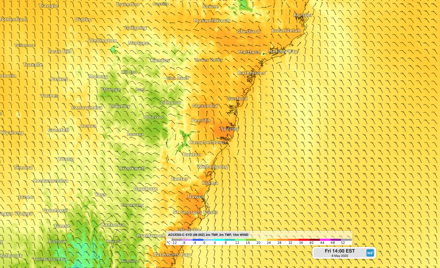
Image: Forecast surface temperature and wind on Friday afternoon, showing northwesterly winds transporting warm air over the Sydney Basin.
The city’s top of 28.5 degrees was its highest temperature this late in autumn since 2012. Impressively, it was also just the fourth time on record that Sydney has been this warm, this late in the season, with data going back to 1859.
Sydney is forecast to dip to a relatively warm 16 degrees overnight and reach the mid-twenties on Saturday as warm air lingers over the city. A cool change will arrive on Saturday night, dropping the city’s maximum temperature back to about 19 degrees on Sunday.
- Written by Ben Domensino, Weatherzone.com.au
Comments
Latest Video

Colder nights/mornings, polar change coming Sun/Mon
The nights and mornings ahead will be colder in a number of regions – but an even colder change is…
Related Articles

ClimateWatch: JUNE outlook as El Niño continues to build
June has kicked off in NEUTRAL again as far as El Niño is concerned, but it is expected to form…

ClimateWatch: May outlook & El Niño discussion
Everyone is talking about El Niño so in this month’s update we discuss when it may be forming and what…

Wed April 29 – No video today sorry!
Apologies but due to some tech hassles with our camera (and a fairly quiet weather forecast) we don’t have an…


josh on 8/05/2020 9:35pm
so aussie has gone back into drought which will come here and stop our winter weather right? just like what happened this year. their drought came here.