Antarctic Blast: Wind chill & Below normal temperatures (+13 Maps)
27/09/2020 6:38pm

> From the WeatherWatch archives
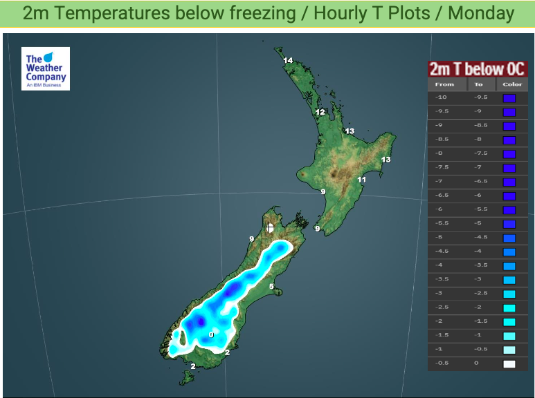
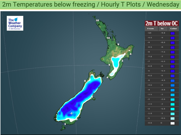
Southern New Zealand will experience sub-zero wind chill until Wednesday as the Antarctic side of this storm is now dredged up.
Temperatures nationwide will drop and parts of the South Island – both by day and by night – will be more than 8 degrees below average at times.
To track wind chill in your local area for the next couple of days (in fact HOURLY for the next 10 Days) please use the automatic wind chill calculator which you’ll find at www.RuralWeather.co.nz. This also covers all suburbs so if you live in Dunedin you may find it interesting to use too!
Wind chills and temperatures this low will be deadly for newborn lambs and the coldest of the air arrives tonight and into Tuesday.
You also see our Below Zero temperature maps here: www.weatherwatch.co.nz/maps-radars/temperature/below-zero
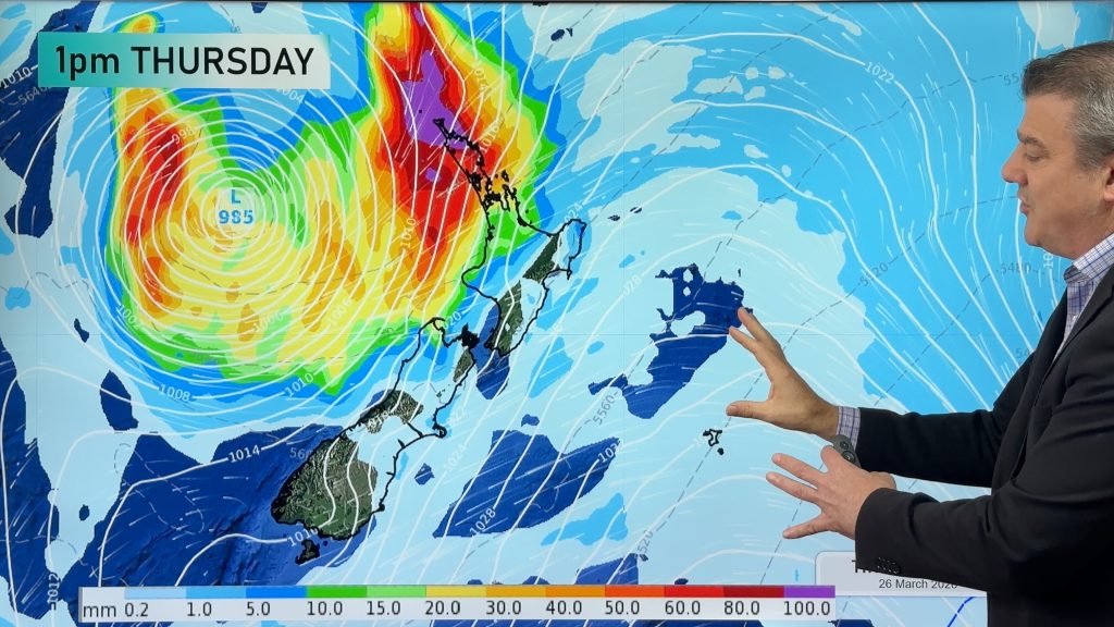
The positive news is that mild weather returns by Thursday and Friday to the south.


Comments
Before you add a new comment, take note this story was published on 27 Sep 2020.
Latest Video

Update on severe weather around NZ as storm moves in + outlook for next week
Heavy rain and damaging wind gusts are forecast today, tonight and into Friday across parts of New Zealand as a…
Related Articles
Update on severe weather around NZ as storm moves in + outlook for next week
Heavy rain and damaging wind gusts are forecast today, tonight and into Friday across parts of New Zealand as a…

Subtropical storm moving in, gales and some heavy rain, especially Thu/Fri
Heavy rain and gale winds will slowly move down the country over the next 24 to 36 hours a subtropical…
Tropical storm to bring severe weather to NZ, gales & heavy rain
A tropical cyclone is today leaving the tropics and will grow into a larger storm system for a time in…


Add new comment