Antarctic Blast: Updated Snow maps and nationwide windchill (+18 Maps)
28/09/2020 6:19pm

> From the WeatherWatch archives
Snow flurries to sea level and heavier falls inland are expected for Southland and Otago today and heavier snow through the Southern Alps and Central Plateau.
The Antarctic portion of this storm event peaks today with bitterly cold conditions in the lower South Island.
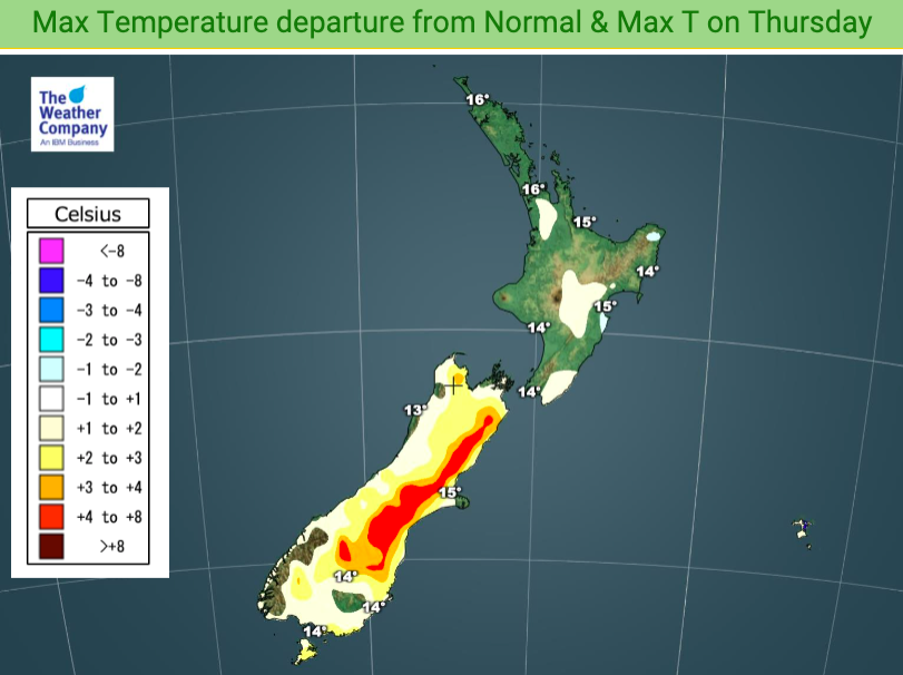
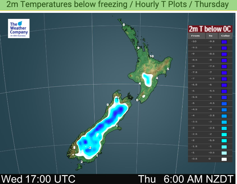
The automatic wind chill calculator at www.RuralWeather.co.nz shows Dunedin has a wind chill of -7C this morning and it ‘warms’ up to -4C in the wind later today. This is also known as the ‘feels like’ temperature. The actual high in Dunedin city at the warmest point today is around +3 or +4C. Snow showers are in the forecast but totals won’t accumulate to much at sea level.
Invercargill is similar – some snow is possible to sea level but totals don’t look huge. The wind chill in Invercargill will ease later today but will still remain below zero (-2C). The actual high is around +4, maybe +5.
Further inland and the snow totals lift. from 5cm to 10cm, then 10cm to 35cm going into the ranges.
Even the Nelson Ranges may get 45cms of snow today.
Queenstown has a high of +2 today and windchill of -7C this morning easing to -2C windchill by the end of the day as the main Antarctic portion starts to already slide away and out to the east.
For newborn livestock it’s more about the windchill plus damp more than just the snow falling. Some snow totals aren’t too extreme but when you factor in windchill plus being wet from rain or melted snow the conditions can soon prove deadly for newborn lambs. The positive is that milder weather bounces back in the next 48 hours.
To see the automatic windchill calculator – HOURLY for 10 full days – visit www.RuralWeather.co.nz


WeatherWatch.co.nz / RuralWeather.co.nz
Latest Video

More eastern rain, but a drier long weekend coming
Rain continues today along the eastern South Island and lower North Island, coming in from the east with heavy falls….
Related Articles
More eastern rain, but a drier long weekend coming
Rain continues today along the eastern South Island and lower North Island, coming in from the east with heavy falls….

More heavy rain, snow – but large dry areas, especially as we go into the long weekend
Heavy rain will continue for parts of Canterbury and Marlborough over the next day or two and it will gradually…

Large low brings rain, downpours & some snow – gets colder as the week progresses
Low pressure will cross the upper North Island in the days ahead and that set-up actually pushes more heavy rain…

