Animation: The two extreme sides of calm highs
14/05/2019 2:34am

> From the WeatherWatch archives
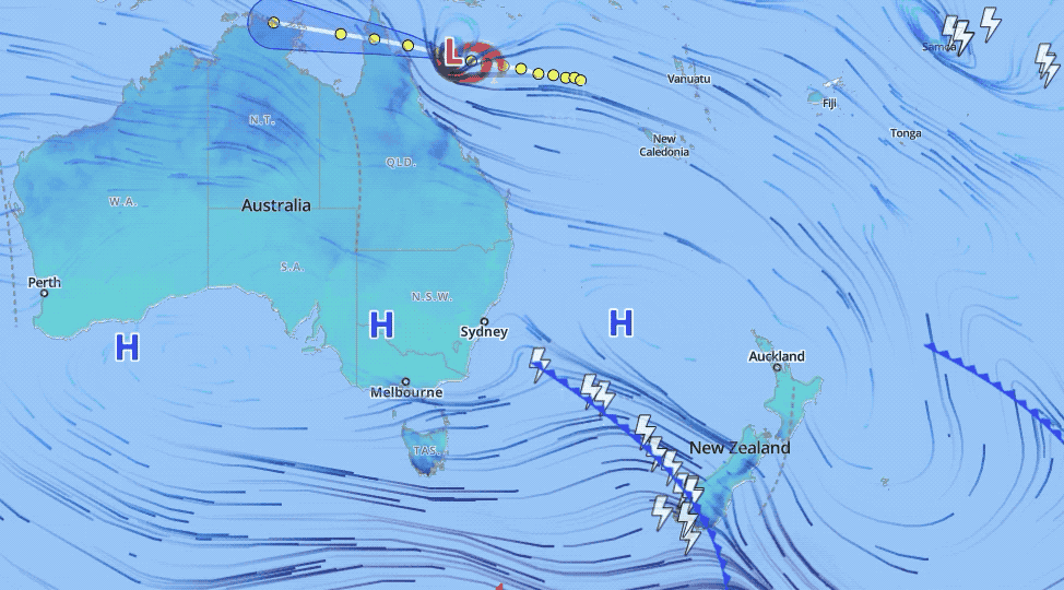
Most of us know the centre of high pressure is often calm and settled but the outer edges can be stormy and today that is highlighted well with a tropical cyclone on the northern fringes and an active Autumn cold front on the southern edge of high pressure.
The line of highs continue to bring settled weather over a large portion of Australia and part of the Tasman Sea but the anticyclonic flow around the centre of this enormous area of of high pressure means the southern side is scooping up Southern Ocean fronts while the northern side is caught up in a tropical cyclone.
The high will help weaken Cyclone Ann while the edge of the high pressure means windy weather and active cold fronts will push into New Zealand from the Southern Ocean and lower Tasman Sea area for the rest of this week and weekend.
Early next week high pressure finally crosses New Zealand with calm conditions and drier skies.
– WeatherWatch.co.nz
Comments
Latest Video

Westerlies continue, sub-tropical for some
West to north-west winds blow through the South Island and lower North Island today bring heavy West Coast rain and…
Related Articles
Westerlies continue, sub-tropical for some
West to north-west winds blow through the South Island and lower North Island today bring heavy West Coast rain and…

Westerly change this week, unsettled but large dry areas
Westerlies kick back in again this week which will bring a break to those in the east as far as…

Matariki, the long weekend + the outlook for next week
Wet weather and cloud continues along the eastern side of the country with the heaviest rain now moving into northern…


Guest on 15/05/2019 2:44am
highs sit over Australia in winter and the fronts come up will that still happen