10:15PM: Next Active Front arrives in lower North Island – heading northwards (+Maps)
10/06/2022 10:15am

> From the WeatherWatch archives
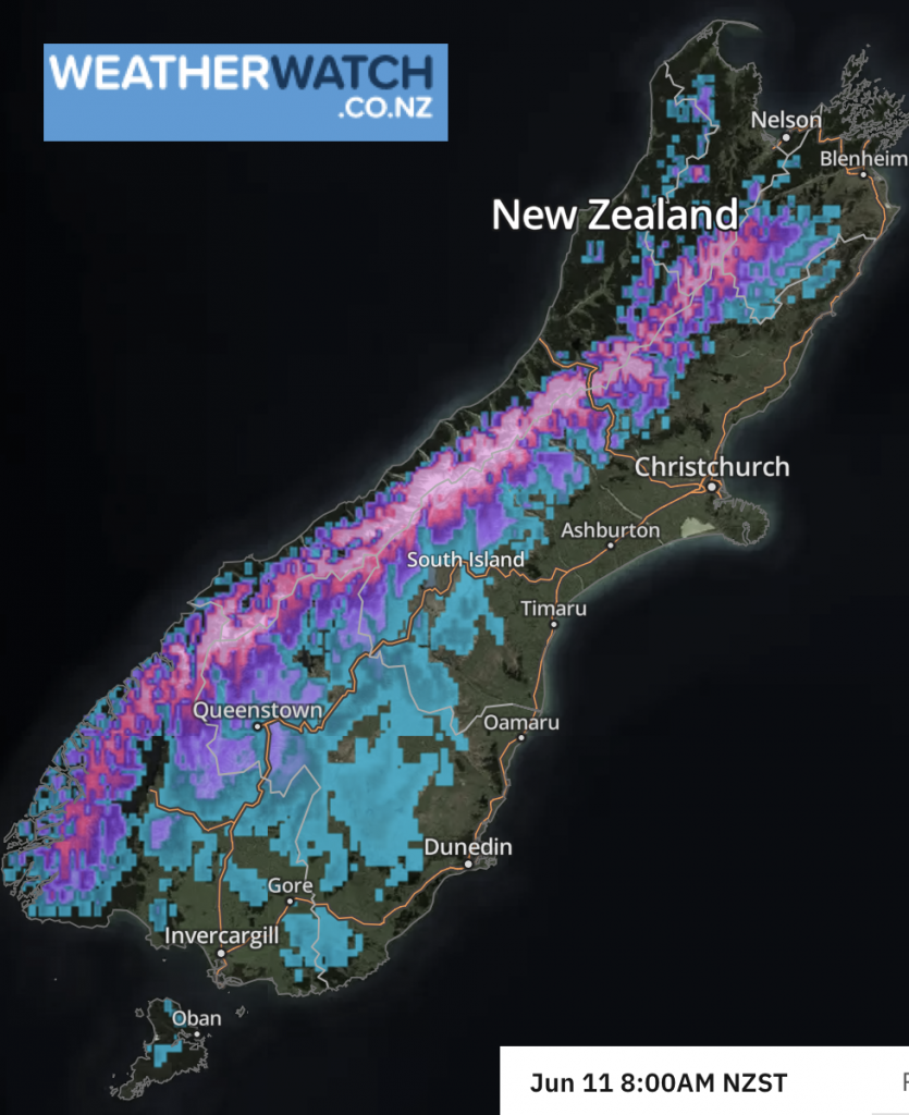
Front 2 has now arrived in the lower North Island bringing downpours and thunderstorms as it quickly heads northwards.
As forecast on Thursday, an active cold front has Friday moved into the western side of NZ with scattered thunderstorms, squalls and even damaging hail. Now the next active cold front is moving up the North Island overnight Friday and into Saturday morning.
Large hail was earlier Friday recorded on the West Coast with a damaging shower producing hail larger than grapes.
Friday morning’s front was one of two active fronts coming in to NZ from the Tasman Sea today.
Front 2 arrived in Westland on Friday morning and reached Cook Strait around 9 to 10pm Friday, and tonight/overnight will move up the western side of the North Island – bringing similar risks to previous fronts in the past 24 hours (ie, a short burst of potentially severe weather, squalls, thunder, hail, strong wind). This is quite an active front and has a number of thunderstorms within it. Short and sharp.
The weather in the coming days will be similar with several surges of squally showers off the Tasman Sea caused by a storm still deepening south of NZ – and likely to remain there until early next week.


Comments
Latest Video

Large low brings rain, downpours & some snow – gets colder as the week progresses
Low pressure will cross the upper North Island in the days ahead and that set-up actually pushes more heavy rain…
Related Articles
Large low brings rain, downpours & some snow – gets colder as the week progresses
Low pressure will cross the upper North Island in the days ahead and that set-up actually pushes more heavy rain…

WeatherWatch App launches real-time local lightning tracker!
A bolt out of the blue! WeatherWatch has launched a live, real-time lightning tracker, enabling Kiwis to gain access to data provided by the…

Polar airflow + northern low = pockets of heavy rain & snow
A colder change is coming – and so too is a large low which will develop and grow over northern…


Phil Smith on 9/06/2022 10:09pm
Unconfirmed tornado in Te horo beach this morning with fences down and horses running up the road