15m waves, 1m of snow, severe gales, squally rain – Here are 4 maps to make sense of it all
1/08/2019 11:17pm

> From the WeatherWatch archives
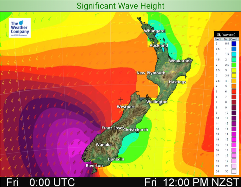
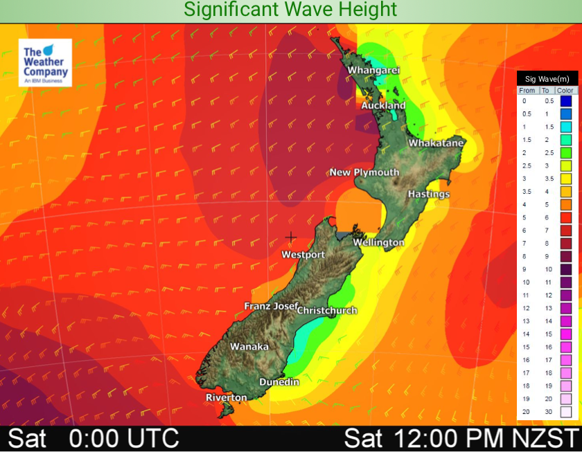
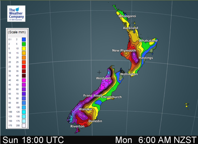
A Southern Ocean storm is pouncing on the South Island today bringing 15 metre waves to the remote south west corner along with severe gales, heavy snow and squally downpours with hail and isolated thunder spreading elsewhere across New Zealand.
We also have some large areas of dry and sunny weather, thanks to our mountains and ranges. Those facing to the east to north east will have lower rainfall totals, slightly higher temperatures and less dangerous marine conditions.
The west, on the other hand, is rough. The ‘rough west coast’ lives up to its name with highly dangerous beach and marine conditions across the next 72 hours at least. Boaties and those fishing on the rocks are advised to postpone things until Tuesday next week due to the dangers posed.
Meanwhile heavy snow will fall across the Southern Alps, some lighter falls may get right down to 100 or 200m, mainly around Southland and Otago, while Fiordland has a chance of sea level snow. Southland will also see low level snow flurries and sleet, but it may not settle. Sunday will see snow falling to the lowest levels of Southland, Otago and Canterbury – although Canterbury looks fairly dry at this stage.
Regions facing north to north east in the upper North Island look to be the most settled this weekend. For example the Bay of Islands, eastern Coromandel Peninsula and Gisborne.

– WeatherWatch.co.nz
Latest Video

Cold weekend, frosts return with high pressure, then a low late next week
The subantarctic airflow spreads over NZ today/tonight and into Saturday, dropping temperatures nationwide. Snow flurries are possible today to lower…
Related Articles
Cold weekend, frosts return with high pressure, then a low late next week
The subantarctic airflow spreads over NZ today/tonight and into Saturday, dropping temperatures nationwide. Snow flurries are possible today to lower…

Wintry burst of weather: Snow, squally showers then sunshine & frosts
A polar change (another one!) arrives on Friday for the South Island and goes nationwide on Saturday, leaving NZ under…

Antarctic southerly for parts of NZ Fri & Sat
For the first time this year a southerly from off Antarctica is heading towards the South Island, followed by more…

