
> From the WeatherWatch archives
Low pressure that has lingered all week over New Zealand is finally, slowly, about to drift away allowing a big high to roll in this weekend.
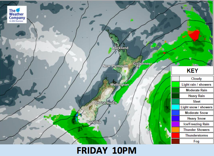
The area of lingering rain will move away eastwards today and leaves the North Island from Thursday afternoon.
A period of heavy showers and isolated lightning may occur during Thursday night in Auckland and Northland due to a brief cold change.
While the North Island and the western side of the South Island will be mostly sunny, the eastern side of the country will be mostly cloudy with rain or showers at times until Friday morning, caused by southeasterly winds from the departing low pressure to the east.
A period of settled and quite sunny weather is expected for many parts of the country (except Southland) from tomorrow Friday to Tuesday next week, with the main high coming across New Zealand on Sunday and Monday. A few showers will remain on both Friday and Saturday, with Sunday and Monday the driest days coming up nationwide.
Daytime temperatures will gradually rise to normal levels by Sunday afternoon after a cooler change for some over the next 48 hours.


– WeatherWatch.co.nz
Latest Video

Cold weekend, frosts return with high pressure, then a low late next week
The subantarctic airflow spreads over NZ today/tonight and into Saturday, dropping temperatures nationwide. Snow flurries are possible today to lower…
Related Articles
Cold weekend, frosts return with high pressure, then a low late next week
The subantarctic airflow spreads over NZ today/tonight and into Saturday, dropping temperatures nationwide. Snow flurries are possible today to lower…

Wintry burst of weather: Snow, squally showers then sunshine & frosts
A polar change (another one!) arrives on Friday for the South Island and goes nationwide on Saturday, leaving NZ under…

Antarctic southerly for parts of NZ Fri & Sat
For the first time this year a southerly from off Antarctica is heading towards the South Island, followed by more…

