Winter? It may feel more like spring already especially as westerlies soon kick in (+4 Maps)
25/07/2018 3:09am

> From the WeatherWatch archives
We’re smack bang in the middle of winter and yet we’re in a warmer than usual phase with mild westerlies about to kick in. We’re not talking tropical heat or anything like that, but we are talking about temperatures above average either by day or by night, or for some regions both day and night.
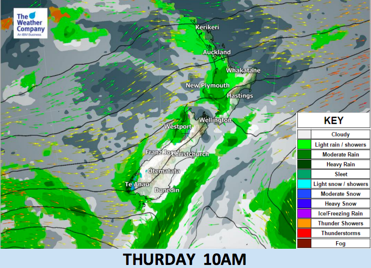
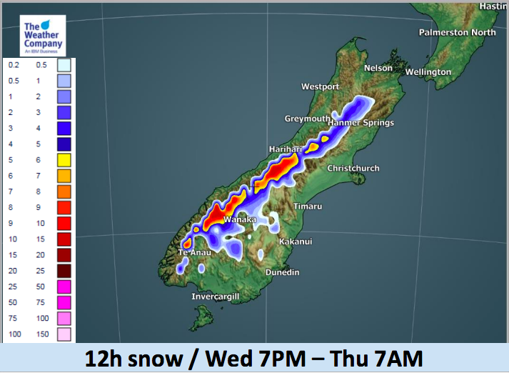
While the south eastern corner of Australia gets hit by cold southerlies we’re seeing more of the westerly after thought and that is creating snow on the Southern Alps, colder days in the lower South Island but, generally, it’s bringing a milder flow of weather with most regions looking frost free.
We may have a few more frosts on Thursday morning well inland but the westerlies are coming.
Don’t be too fooled by the mild weather. As SE Australia is seeing there are plenty of big southerlies that can come in at any time, but as we head through what is usually the coldest time of the year New Zealand is indeed in a warmer than average flow for the most part. Major snow storms and cold blasts can hit anytime in August, September and even into October but the coldest point of the year is usually around mid July to mid August, precisely 6 months after our hottest period of the year, mid January to mid February.
The first week of August 2018 also looks milder than average for a number of areas with more lows forming in the Tasman Sea and more westerly quarter winds.


– By head forecaster Philip Duncan, WeatherWatch.co.nz
Latest Video

NZ: 8 Day outlook as gales & rain ease, high pressure builds
Damaging wind gusts and heavy rain will continue to affect some parts of the North Island and brushing Marlborough today…
Related Articles
NZ: 8 Day outlook as gales & rain ease, high pressure builds
Damaging wind gusts and heavy rain will continue to affect some parts of the North Island and brushing Marlborough today…

Pockets of hit & miss heavy rain, snow moves northwards
Low pressure continues to slowly move across the upper North Island and for some that will bring the sun out,…

Slow go for northern low & southern cold
For the next few days low pressure will crawl over the upper North Island, driving in rain as far south…

