Weather headlines (x3) for Wednesday: Snow flurries lift in the south, Winds ease tomorrow, Warm in the east
14/06/2022 7:00pm

> From the WeatherWatch archives
Here’s what is making the weather headlines today.
SNOW FLURRIES IN THE FAR SOUTH LIFT
Snow flurries about the far south and Fiordland to about 500 or 400m this morning will gradually lift, especially from afternoon to above 800m tonight. Showers clear for Otago this evening and become restricted to Southland.
STILL A LITTLE WINDY TODAY, EASING TOMORROW
Winds from the west or southwest will still be blustery or perhaps even strong about some coastal areas today as in the map below, the western North Island and the southeastern corner of the South Island stand out here. But tomorrow, winds will have backed off for many apart from the far south and for the lower North Island where winds may still be a bit breezy.
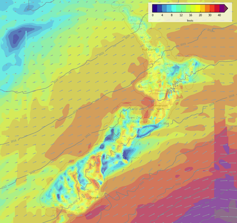
Wind map – Wednesday 3pm 
Wind map – Thursday 3pm
EASTERN REGIONS WARM TODAY AND TOMORROW
Enjoy today and tomorrow in the east of the country, thanks to a westerly airflow temperatures will be in the mid to late teens for Canterbury up through to Gisborne. It should be generally sunny too but there may be some high cloud about.
A bit frosty this morning to start though for the eastern South Island.


Latest Video

Snow, rain showers & cold polar southerlies set to return
Friday will be a wintry day across NZ as the next cold front arrives, bringing snow to lower levels of…
Related Articles
Snow, rain showers & cold polar southerlies set to return
Friday will be a wintry day across NZ as the next cold front arrives, bringing snow to lower levels of…

Frosts, late week rain & another cold weekend coming
High pressure will cross NZ over the next few days meaning more cold nights/mornings with frosts, but a nor’wester will…

NZ: Cold & windy, then calm & frosty
Downpours, some squally with the chance of thunderstorms and even small tornadoes are possible for parts of NZ over Friday…

