Weather headlines (x3) for Thursday: Front is closing in, Front moves over Friday, Snow SI high country Fri morning
6/07/2022 7:00pm

> From the WeatherWatch archives
Here’s what is making the weather headlines today.
SETTLED BUT A WARM FRONT IS CLOSING IN
A high pressure system brings mainly settled weather today, expect plenty of high cloud though spreading out ahead of a warm front approaching from the west. This front brings rain into Northland this afternoon then other western regions this evening, scattered rain spreads into eastern regions overnight.
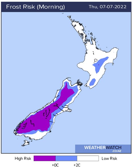
It will be a frosty start this morning for the South Island especially inland, perhaps inland parts of the North Island too.

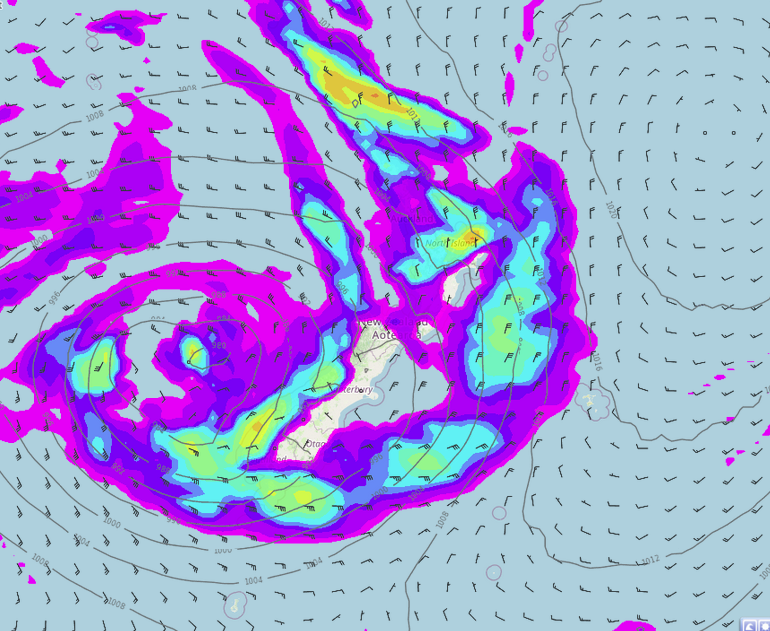
MSLP / Rain map – Thursday 3:00pm 
MSLP / Rain map – Friday 12:00am
FRONT PUSHES OVER THE COUNTRY ON FRIDAY
A gusty to strong northeasterly airflow changes to the north in the afternoon on Friday as a front passes over the country moving from west to east. Expect rain for western regions with a chance of heavy falls, Nelson / Marlborough and Bay Of Plenty may get some heavy rain too. Rain eases once the front pushes through but a trough bringing a second round of heavy rain or showers moves into the West Coast in the afternoon then the southwestern corner of the North Island in the evening.
After some morning rain eastern regions may start to clear up in the afternoon with sun breaking through, rain moves back into Wairarapa in the evening. Expect warm temperatures to develop in the afternoon Banks Peninsula northwards getting into the mid teens, the eastern North Island reaches as high as 18 to 19 degrees.
SNOW FOR THE LAKES DISTRICT AND MACKENZIE COUNTRY FRIDAY MORNING
There is a pool of cold air above the Central Otago Lakes District and Mackenzie Country on Friday morning, this combined with some heavy rain could bring some heavy snow above 800m. Snow falling to 700m looks possible but may get as low as 600m. From afternoon upper air temperatures lift and therefore the snow level will lift also.

Latest Video

Large low brings rain, downpours & some snow – gets colder as the week progresses
Low pressure will cross the upper North Island in the days ahead and that set-up actually pushes more heavy rain…
Related Articles
Large low brings rain, downpours & some snow – gets colder as the week progresses
Low pressure will cross the upper North Island in the days ahead and that set-up actually pushes more heavy rain…

WeatherWatch App launches real-time local lightning tracker!
A bolt out of the blue! WeatherWatch has launched a live, real-time lightning tracker, enabling Kiwis to gain access to data provided by the…

Polar airflow + northern low = pockets of heavy rain & snow
A colder change is coming – and so too is a large low which will develop and grow over northern…

