Weather headlines (x3) for Friday: Warm in the east, Rain central NZ on Saturday, Snow lower South Island Saturday
28/07/2022 7:00pm

> From the WeatherWatch archives
Here’s what is making the weather headlines today.
WARM FOR HAWKES BAY YESTERDAY, WARM AGAIN TODAY
Napier reached between about 19 to 20 degrees yesterday afternoon, not bad for a winters day. Napier in July would normally expect a max high around 14 degrees.
Fear not, another warm afternoon is on the way today, perhaps not reaching 20 but 18 to 19 degrees looks possible.

RAIN FOR CENTRAL NZ ON SATURDAY
A front coming out of the Tasman Sea still looks to bring some rain into central New Zealand on Saturday, at this stage the rain (possibly heavy) is favoring the lower North Island. Overnight rain pushes a bit further northwards then becomes more restricted to the east coast during Sunday.
While the West Coast gets some rain on Saturday also it’s more run of the mill rain for the West Coast and not out of the ordinary.
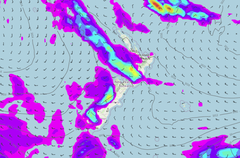
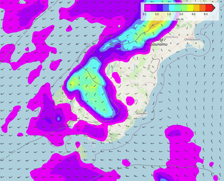
SOME SNOW ABOUT THE LOWER SOUTH ISLAND ON SATURDAY
A period of rain or showers passing over Southland and Otago on Saturday afternoon has some cold air associated with it, some snow may fall to about 400m then clearing in the evening. This won’t be a heavy fall of snow but 1-3cm is possible to 400m, 3-5cm above 500m.
Latest Video

Frosts, late week rain & another cold weekend coming
High pressure will cross NZ over the next few days meaning more cold nights/mornings with frosts, but a nor’wester will…
Related Articles
Frosts, late week rain & another cold weekend coming
High pressure will cross NZ over the next few days meaning more cold nights/mornings with frosts, but a nor’wester will…

NZ: Cold & windy, then calm & frosty
Downpours, some squally with the chance of thunderstorms and even small tornadoes are possible for parts of NZ over Friday…

WeatherWatch App launches real-time local lightning tracker
A bolt out of the blue! WeatherWatch has launched a live, real-time lightning tracker, enabling Kiwis to gain access to data provided by the…

