
> From the WeatherWatch archives
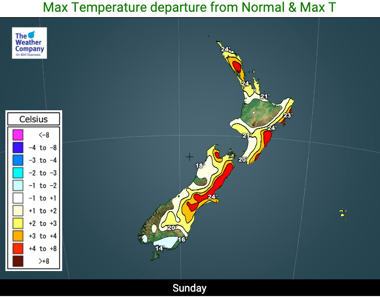
Sunday leans warmer than average for many places thanks to the wind flows, but a weak cold front will see temperatures drop ahead of a very slow moving high pressure system.
The next incoming high will take much of next week to arrive from south of Australia. Over Monday and Tuesday in particular it will bring a more southerly quarter airflow.
This means Monday will lean a bit colder than average in the South Island (and fairly normal in the North Island) then cooler into the North Island by Tuesday. Things warm up again later next week.
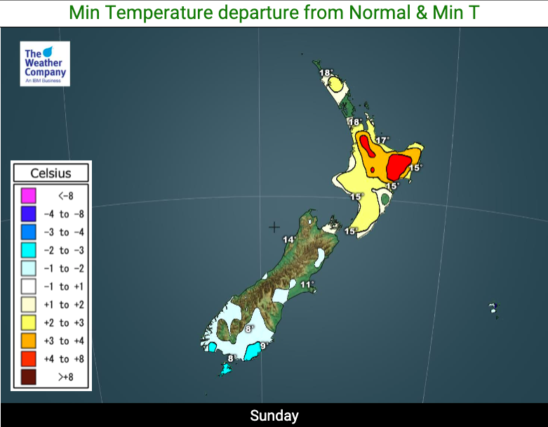
Monday night and Tuesday night will be several degrees below average in the South Island and inland frosts may even be possible on Wednesday morning (or at least near it).

Comments
Latest Video

Slow go for northern low & southern cold
For the next few days low pressure will crawl over the upper North Island, driving in rain as far south…
Related Articles
Slow go for northern low & southern cold
For the next few days low pressure will crawl over the upper North Island, driving in rain as far south…

Slow moving low to track over northern NZ
A low pressure zone will slowly cross the North Island over the coming days, bringing hit and miss pockets of…

NI low pressure, SI polar change
Low pressure will move over the upper North Island this week, bringing hit and miss pockets of heavier rain into…


Peter Langer on 21/03/2020 6:41pm
a nother failed tropical season for the north island it seems I wonder what aus would do if they had two in the row like here