UPDATED: Heavy Snow now falling in parts of inland Otago & Canterbury
18/06/2015 1:33am

> From the WeatherWatch archives
Updated 6:45pm — Heavy snow flurries were affecting parts of Otago and Canterbury, down to about 300 or 400 metres this afternoon. Heavy snow fell in Wanaka, while WeatherWatch.co.nz’s weather analyst Aaron Wilkinson was reporting snow falling as far north as inland mid-Canterbury.
WeatherWatch.co.nz forecast earlier today that snow in Canterbury was looking slightly lower than it was looking a day or so ago, now it’s already falling in places closest to the Southern Alps.
South Canterbury now looks to get snow down to 200 or 300m, while Mid Canterbury will see snow as low as 400m this afternoon, and North Canterbury now looking like it will get some snow too – down to around 500 or 600m.
Callum Jones sent us through this picture, with the caption “Mayfield currently as at 1:20pm”

@WeatherWatchNZ I’m in South canterbury (timaru area) no snow but heavy rain and winds pic.twitter.com/NvOnOyhhib
— mada official (@madanz24) June 18, 2015
Further down to sea level and snow falls as rain – this means there will be a sleety snow/rain mix between 200m and 400m later today in both Canterbury and Otago and likely Southland and Fiordland.
Meanwhile heavy rain is falling at sea level in parts of Canterbury and Otago. “I’m in South Canterbury (Timaru area) no snow but heavy rain and winds” says Twitter user @madan24 on the @WeatherWatchNZ Twitter wall. He posted photos of surface flooding on the street.

On the opposite side, the West Coast rain has very heavy in places also. West Coaster David Craze says it’s been heavily raining all morning. “40mm of rain since 07.00hrs. River is also getting higher”.
Rain is falling as snow at higher altitudes.
@Guycg77 I would wear stubbies but it is bloody freezing pic.twitter.com/5tmQ2pbOKB
— Ben Jaunay (@BenJaunay) June 18, 2015
“Heavy snow arrived in Wanaka!” tweeted Luke Atherton.
Bleak Bus. pic.twitter.com/fkn96w2iv3
— Donna R (@kebabette) June 18, 2015
Hyde, an inland community in Otago south west of Oamaru, has rain falling at the moment @wirehuntphoto tells us on Twitter. “280 metres above sea level – Snow would be another 100+ metres from here” says @wirehuntphoto.
@WeatherWatchNZ @dairymanNZ dismal view from office window pic.twitter.com/YPoTjMHtro
— Sara (@Sara23360129) June 18, 2015
“Started snowing heavily in Mayfield” Callum Jones wrote on the WeatherWatch.co.nz Facebook page a short time ago.
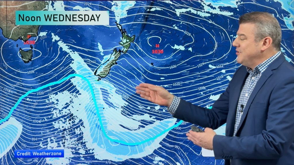
Overnight snow levels may drop even further – WeatherWatch.co.nz says the coastal elements and big ranges of the South Island make snow forecasting tricky, so we’ll continue to monitor and update into this evening.
Areas further south are also in for snow at different stages on Thursday, while northwest winds from North Canterbury northwards will gust strong – gales possible at times – as far up as the lower North Island, before easing in the afternoon.
The West Coast of the South Island is in for torrential falls too, while Fiordland is looking windy as well as wet.
DETAILED FORECASTS
For those in Dunedin and Christchurch and nearby towns please check out WeatherWatch.co.nz’s Detailed Forecasts:
- Dunedin: www.weatherwatch.co.nz/forecasts/dunedin
- Christchurch: www.weatherwatch.co.nz/forecasts/christchurch
– Photo: Donna R – Bleak bus
– WeatherWatch.co.nz
Comments
Before you add a new comment, take note this story was published on 18 Jun 2015.


Add new comment