Tuesday’s weather headlines (x3): Warm this afternoon for Hamilton, Ridge clings on, Front on Friday
7/03/2022 6:00pm

> From the WeatherWatch archives
WAIKATO DUE TO HIT 27 DEGREES THIS AFTERNOON
Upper and western parts of the North Island have a warm afternoon on the way with temperatures likely to get into the mid twenties, some inland spots like Hamilton reach 27. The inner South Island has warm temperatures also getting into the mid twenties. Cloud and a few showers will mean South Westland is the coolest, perhaps not getting out of the late teens, it may hit 20 or 21 in some spots though.
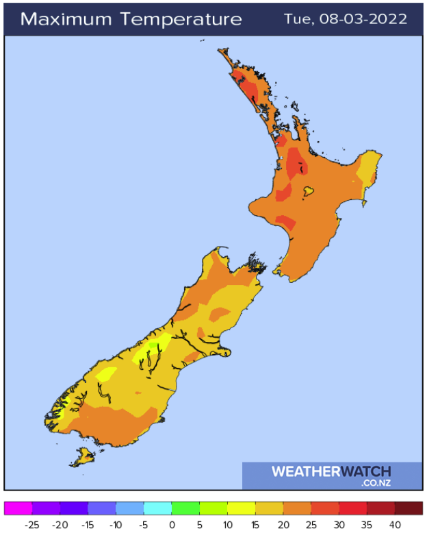
A RIDGE CLINGS ON TILL THURSDAY
A ridge of high pressure stays with us today through to Thursday, this means we’ll be having mainly settled weather during this time. Still, areas of morning low cloud or fog are likely and some cloud about inland hills and ranges in the afternoons. Cloud affects the lower South Island and up the east coast through to Canterbury on Wednesday thanks to a week front. Also the odd shower may continue to pester Coromandel through to eastern Northland in an easterly airflow. Temperatures during the afternoons will be warm especially about inland areas.
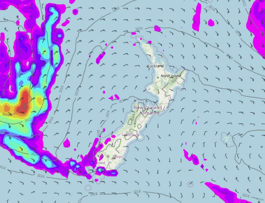
COLD FRONT ON FRIDAY
A cold front moves onto the South Island on Friday, this brings some run of the mill rain to the West Coast as it moves through while out east we can expect warm temperatures. The front moves onto the North Island on Saturday but in a weakened state.
Latest Video

More heavy rain, snow – but large dry areas, especially as we go into the long weekend
Heavy rain will continue for parts of Canterbury and Marlborough over the next day or two and it will gradually…
Related Articles
More heavy rain, snow – but large dry areas, especially as we go into the long weekend
Heavy rain will continue for parts of Canterbury and Marlborough over the next day or two and it will gradually…

Large low brings rain, downpours & some snow – gets colder as the week progresses
Low pressure will cross the upper North Island in the days ahead and that set-up actually pushes more heavy rain…

WeatherWatch App launches real-time local lightning tracker!
A bolt out of the blue! WeatherWatch has launched a live, real-time lightning tracker, enabling Kiwis to gain access to data provided by the…

