
> From the WeatherWatch archives
Northland, Auckland, Waikato & Bay Of Plenty
Canterbury
Sunny areas after morning low cloud breaks away, expect some high to then thicken however with a few spots / spells of rain moving through late afternoon then clearing in the evening. Nor’East winds near the coast and northerly winds inland.
By Weather Analyst Aaron Wilkinson – WeatherWatch.co.nz
Latest Video
Long weekend weather + outlook as June starts
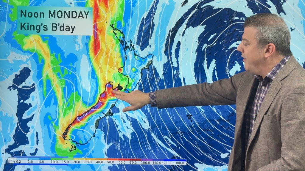
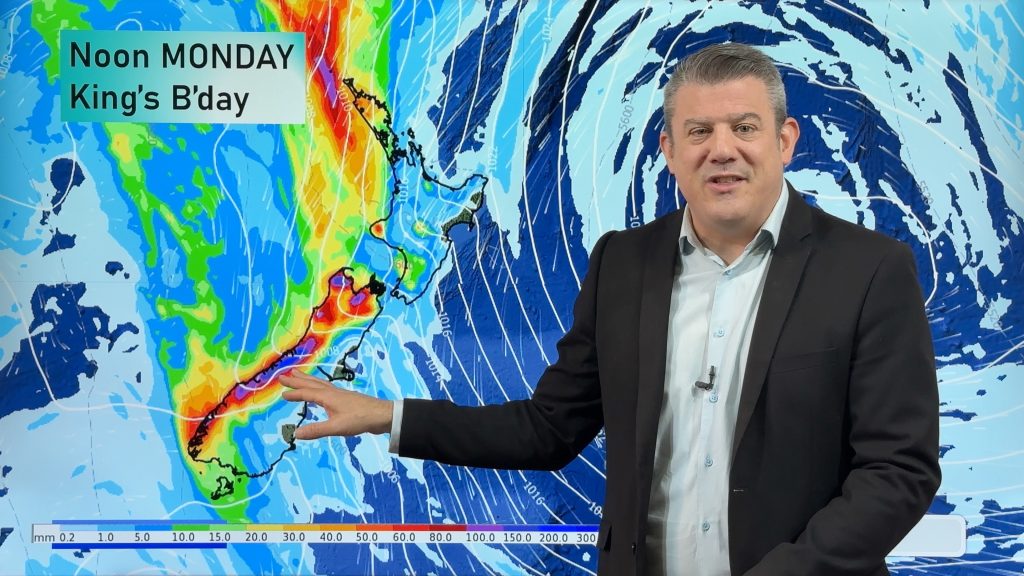
There will be large dry areas this weekend but the weather is going downhill with rain and wind developing in…
Related Articles
Long weekend weather + outlook as June starts
There will be large dry areas this weekend but the weather is going downhill with rain and wind developing in…
Heavy rain & gusty winds for parts of NZ this long weekend
The long weekend starts off mostly settled and dry, then subtropical north to north-west winds kick in with heavy West…
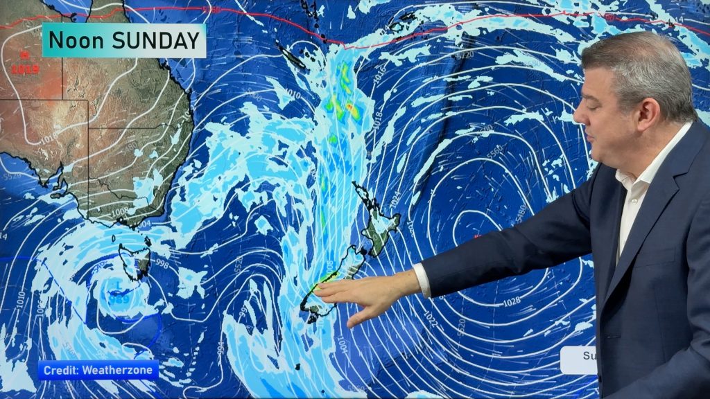
Latest on the long weekend weather
We still have another large high pressure zone to move over the nation, but subtropical northerlies will pick up this…

