Thursday’s weather headlines (x3): Heat, humidity and rain
9/02/2022 6:00pm

> From the WeatherWatch archives
HOT THIS AFTERNOON IN THE EAST AND MOST OF THE NORTH ISLAND
After morning rain clears the eastern South Island can expect a warm afternoon on the way, the eastern North Island becomes very warm too getting into the late twenties or early thirties. Waikato through to Northland sees temperatures in the late twenties or early thirties. Expect muggy conditions also for eastern regions, top of the South Island and most of the North Island.
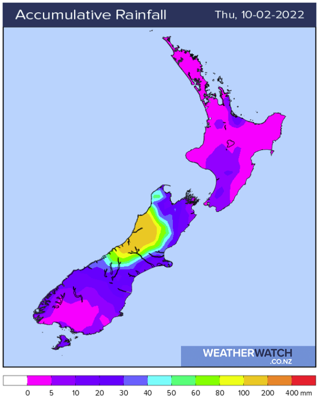
HEAVY RAIN EASES NORTHWESTERN SOUTH ISLAND
Heavy rain about northwestern parts of the South Island eases this morning to showers, any remaining showers clear this evening. Rain about Canterbury may be heavy first thing as well before easing and clearing away.
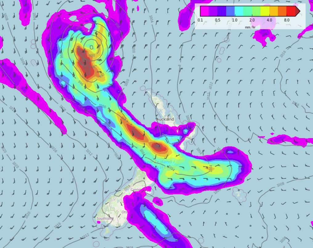
RAIN DUE FOR THE NORTH ISLAND END OF THE WEEK
What will likely be an ex tropical cyclone (low) descending into the Tasman Sea this weekend will bring rain thanks to a stationary front lying across the lower North Island and joining up into the low. While many regions see areas of rain or showers the lower North Island and upper South Island in particular will be the focus for the heaviest rain from Friday evening through till Sunday. The West Coast of the South Island may be the driest spot for this low apart from Buller. Keep up to date with the latest rain maps by clicking here.
Latest Video

Snow, rain showers & cold polar southerlies set to return
Friday will be a wintry day across NZ as the next cold front arrives, bringing snow to lower levels of…
Related Articles
Snow, rain showers & cold polar southerlies set to return
Friday will be a wintry day across NZ as the next cold front arrives, bringing snow to lower levels of…

Frosts, late week rain & another cold weekend coming
High pressure will cross NZ over the next few days meaning more cold nights/mornings with frosts, but a nor’wester will…

NZ: Cold & windy, then calm & frosty
Downpours, some squally with the chance of thunderstorms and even small tornadoes are possible for parts of NZ over Friday…

