Thursday’s national forecast – Anticyclone moves in (+12 maps)
17/11/2021 3:00pm
> From the WeatherWatch archives
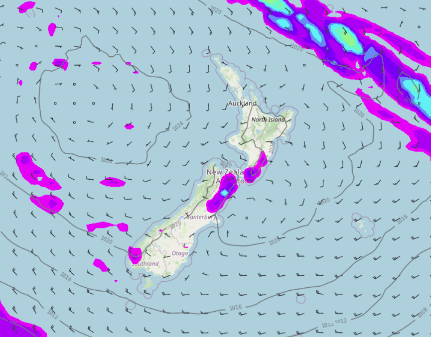
An anticyclone lies over New Zealand today bringing mainly settled weather. We do have a few showers about though, especially Canterbury this morning then inland North Canterbury through to Marlborough this afternoon possibly heavy.
Please refer to your local, hourly, 10 day forecast for more details.
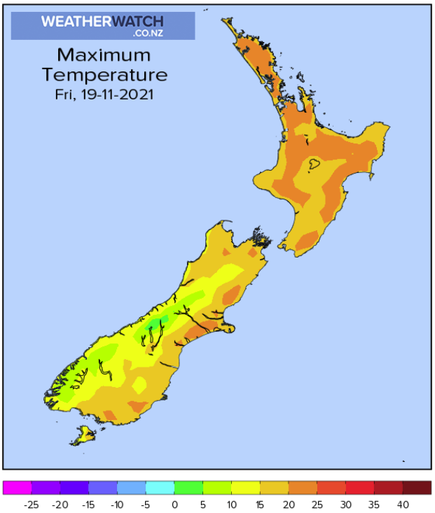
Northland, Auckland, Waikato & Bay Of Plenty
Morning cloud possible otherwise mostly sunny, southwesterly winds. Afternoon sea breezes for Bay Of Plenty and eastern Northland.
Highs: 20-22
Western North Island (including Central North Island)
Morning cloud then mostly sunny, chance of an isolated shower late afternoon / evening about some inland hills and ranges otherwise mainly dry. West to northwesterly winds.
Highs: 17-20
Eastern North Island
Mostly sunny, some cloud with the risk of a shower late afternoon / evening especially about inland hills and ranges. Light winds tend onshore in the afternoon.
Highs: 20-21
Wellington
Mostly sunny with northerly winds.
Highs: 18-20
Marlborough & Nelson
Morning sun, afternoon showers develop possibly heavy with thunderstorms and hail (mainly for Marlborough but showers may reach Nelson for a time in the evening). Light winds tend onshore in the afternoon.
Highs: 18-20
Canterbury
Morning showers clear (possibly heavy at first for South Canterbury), cloud breaks to sunny spells however a few isolated showers develop in the afternoon (mainly inland about the foothills). Showers may become heavy with thunderstorms and hail for inland North Canterbury. East to northeasterly winds.
Highs: 16-20
West Coast
Morning cloud breaks to sunny spells, the odd shower possible at times. Southwesterly winds.
Highs: 15-18
Southland & Otago
Early showers clear Southland then sunny spells increase, Otago is mostly sunny however North Otago may see a few isolated showers in the afternoon about hills / ranges then clearing evening. Westerly winds, tending onshore in the afternoon.
Highs: 15-20
WeatherWatch.co.nz is proud to be setting the international standard for forecasting in NZ – powered by IBM


Latest Video
ClimateWatch: AUGUST outlook & El Niño update
El Niño continues to intensify and will do so right through to the end of our spring in NZ and…
Related Articles
ClimateWatch: AUGUST outlook & El Niño update
El Niño continues to intensify and will do so right through to the end of our spring in NZ and…
Cold frosty southerly heads north, then high pressure and a weekend change
Another shot of colder air is coming for New Zealand over the next day or two, bringing frosts from the…

Cold weekend, frosts return with high pressure, then a low late next week
The subantarctic airflow spreads over NZ today/tonight and into Saturday, dropping temperatures nationwide. Snow flurries are possible today to lower…

