Thursday/Friday – well above normal temperatures for many regions (+5 Maps)
12/11/2020 1:28am

> From the WeatherWatch archives
A large high is rolling in and as it does it has two ways of lifting temperatures to 30 degrees in both islands.
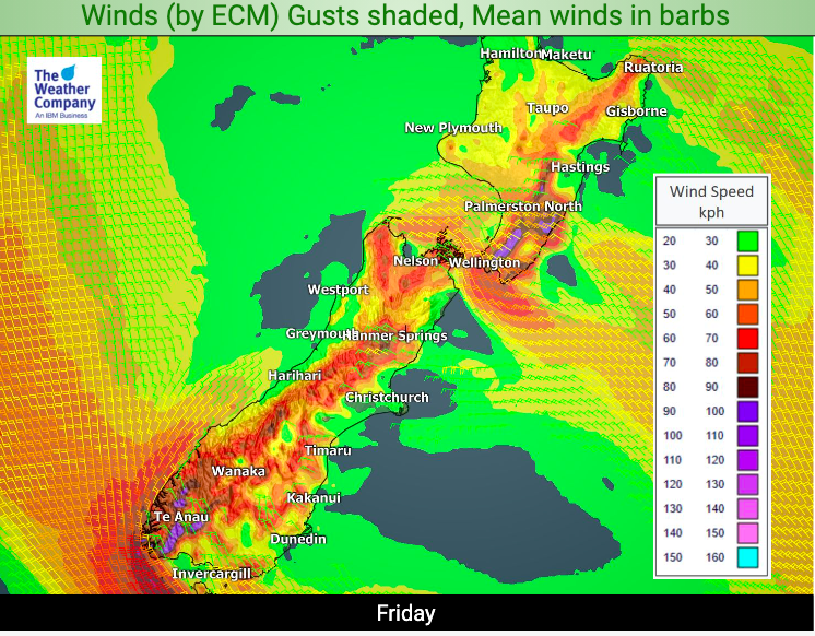
Firstly, as the high shifts northwards it will allow a windy nor’wester to kick in. This nor’wester starts later today and kicks in more so on Friday with a chance of gales in the mountains, ranges and about Cook Strait.
Secondly, as the north to north west flow kicks in it will also bring down sub-tropical airflows on Friday.
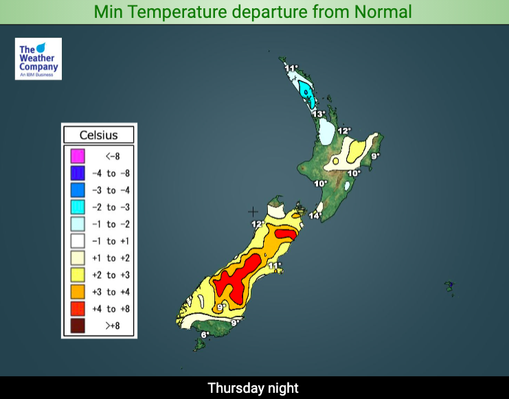
This combo will see temperatures 8 to 10 degrees above normal in the South Island’s interior and 4 to 8 degrees above normal for the North Island’s interior – and leaning to the east.
WeatherWatch.co.nz and RuralWeather.co.nz are both forecasting highs in the mid to late 20s in many regions with some inland areas making it to 30 degrees on Friday. Refer to your local HOURLY forecast for more details where you are.
While the daytime maximums will be well above normal, the nights in the north won’t be. With high pressure bringing light winds the nights in rural Auckland and inland Northland will actually be a few degrees below normal for this time of year tonight. Friday night will be a couple degrees below normal for inland Northland before milder air comes in this weekend there.


Comments
Latest Video

Cold weekend, frosts return with high pressure, then a low late next week
The subantarctic airflow spreads over NZ today/tonight and into Saturday, dropping temperatures nationwide. Snow flurries are possible today to lower…
Related Articles
Cold weekend, frosts return with high pressure, then a low late next week
The subantarctic airflow spreads over NZ today/tonight and into Saturday, dropping temperatures nationwide. Snow flurries are possible today to lower…

Wintry burst of weather: Snow, squally showers then sunshine & frosts
A polar change (another one!) arrives on Friday for the South Island and goes nationwide on Saturday, leaving NZ under…

Antarctic southerly for parts of NZ Fri & Sat
For the first time this year a southerly from off Antarctica is heading towards the South Island, followed by more…


Peter B on 13/11/2020 2:18am
The min/max temp images have green but the legends do not.
WW Forecast Team on 13/11/2020 7:45pm
Hi Peter, the green areas are actually not coloured in – it’s just the satellite image, so it indicates normal temperatures (which is why it isn’t in the key). You’re not the first person to be a little confused by this though! 🙂
– WW