
> From the WeatherWatch archives
This weekend we finally see a gradual end to the low that has brought flooding to Wellington and the West Coast, likely tornado damage in Taranaki, The Far North and Bay of Plenty and dry, warmer than average weather in our drought affected eastern areas.
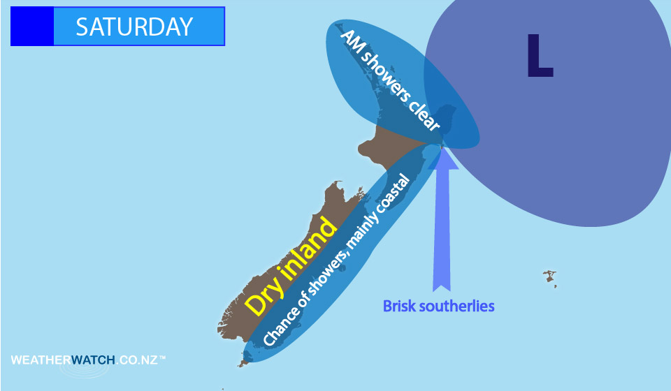
On Saturday the low that has brought all this weather will finally move away to our north east – and behind it will be a much cooler southerly quarter wind flow. This will be strong to gale force in Wellington for a time – and will be equally as strong around exposed parts of East Cape.
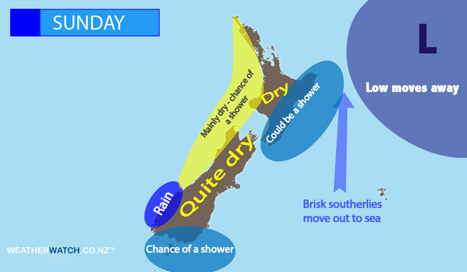
On Sunday those cooler southerlies ease further, as do most showers, as the low drifts further out over the Pacific.
WeatherWatch.co.nz will update you across the weekend on any coastal showers – there will be a few in the southerly quarter wind flow.
The graphics below are quite general – so please use them alongside our daily national forecasts, out everyday at 5am on our website and free app.
Next week a high rolls in – but it will take until at least Wednesday or Thursday to truly cross the country.
(C) – WeatherWatch.co.nz
Latest Video

Polar airflows set to bring cold weekend to NZ
Nor-west winds will be building over parts of NZ going into Thursday with rain on the West Coast becoming heavy…
Related Articles

NZ: Cold & windy, then calm & frosty
Downpours, some squally with the chance of thunderstorms and even small tornadoes are possible for parts of NZ over Friday…

WeatherWatch App launches real-time local lightning tracker
A bolt out of the blue! WeatherWatch has launched a live, real-time lightning tracker, enabling Kiwis to gain access to data provided by the…

Wind, rain, showers & a noticeable temperature drop for all
It will be a colder weekend right across NZ as a sub-Antarctic southerly blows through, bringing frosts, snow flurries and…

