The latest on the tropical storm arriving on Thursday in NZ (+18 Maps)
30/01/2018 11:31pm

> From the WeatherWatch archives
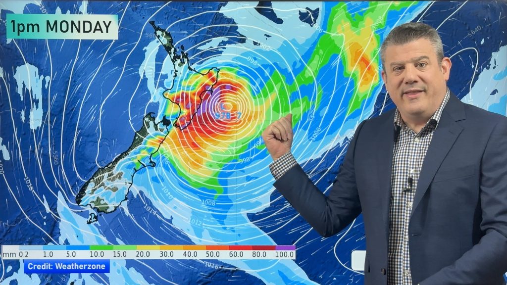
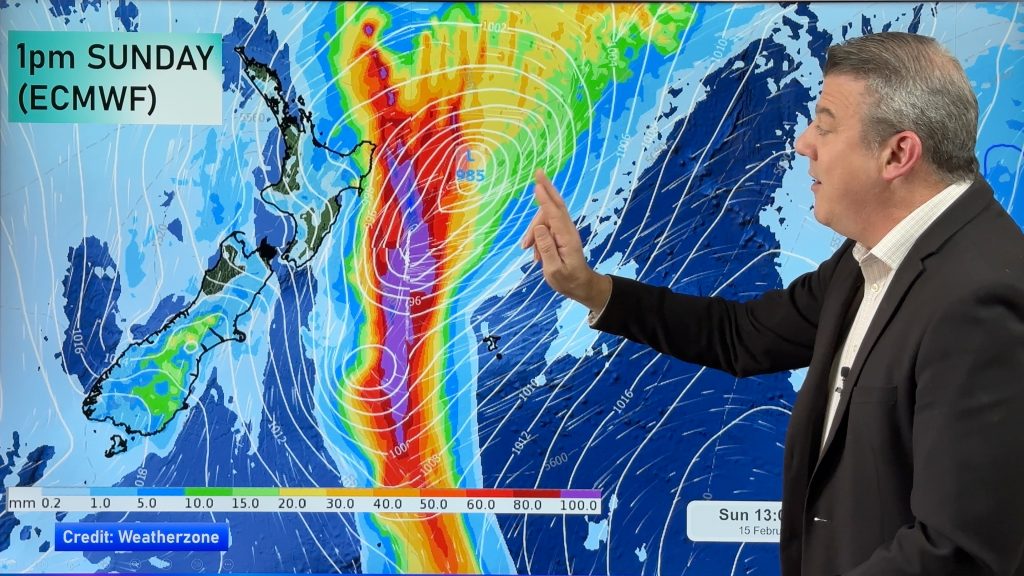
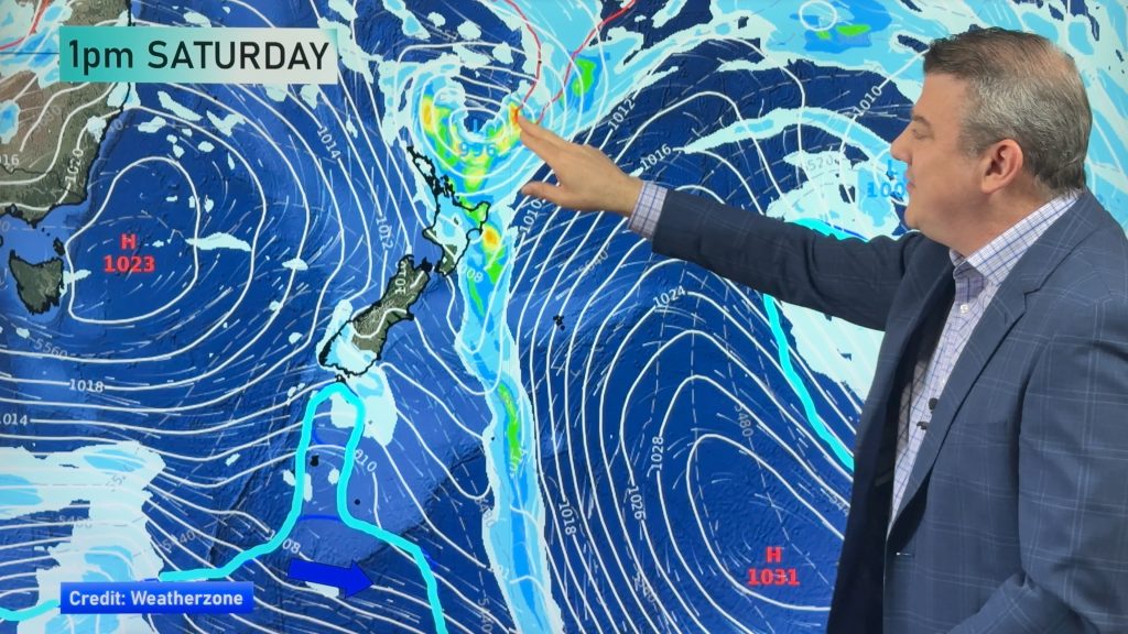
Tropical Cyclone Fehi will lose it’s tropical cyclone status today as the Category 1 storm shifts over cooler waters as it tracks south towards New Zealand. However the storm will retain damaging winds, big seas and flooding rains as it moves into the South Island’s West Coast on Thursday.
There is some positive news – the worst of the rain will fall in Fiordland, a rain forest. The area is used to getting heavy rain – but do not underestimate the energy in this small but aggressive storm.
The storm will make landfall most likely on the West Coast during the day on Thursday. The North Island misses the storm itself for the most part but does not escape the humid and heavy areas of rain the low will drag down.
- Tropical Cyclone Fehi is now tracking quickly southwards at 32km/h, with the low averaging 65km/h winds around the centre.
- Kingston – the capital of Norfolk Island – has already been affected by Fehi’s strong winds.
- Rain will start in the South Island around noon on Wednesday when Fehi and a southern cold front begin to merge.
- The centre is expected to make landfall near Milford Sound, South Island – but could be further north.
- Heavy rain then moves to the North Island from Thursday night to Friday morning.
- 250 to 300mm of rain is possible along the West Coast, especially in the southern half.
- Keep up to date with tax funded warnings from Government forecaster MetService.
- Hot in many places in the east on Thursday but a colder southerly change arrives later as the low tracks through.
- Daytime highs in Central Otago and surrounds could tumble by as much as 20 degrees on Thursday from where they were on Tuesday.
- The remnants of Fehi will track through fairly quickly over Thursday with the worst clearing the South Island by early Friday AM.

 – The red line indicates the heaviest rain – this is the track Fehi will likely take. Map by US Government.
 – The Weather Company (an IBM business). ABOVE total rainfall up to Saturday. BELOW, 12 hour expected rainfall totals.


 – Shows where the heaviest rain will be (Red/orange). Lighter falls in pale green. The Weather Company.


BELOW:
DANGEROUS beach conditions on the western side of both islands, however the West Coast area could be seeing waves of up to 13 metres according to The Weather Company:
WIND MAPS – Areas in purple indicate winds gusting to 100km/h with sustained gales (or near gale) at the centre. Note how the mountains break the winds up – making it hard to be specific about areas worst affected. At this stage the West Coast is most exposed to damaging wind gusts on Thursday. As the low crosses the South Island during the day wind directions will shift around from northerly quarter winds to southerly quarter – affecting new areas. For many it will be blustery only, but powercuts and fallen trees are possible in the South Island as this low moves through. It’s worth pointing out that large mountains – plus the fact the centre of the low will cross the South Island – means the winds will weaken slowly as it tracks across. The North Island gets a bit windy, especially in the usual NW traps from Taranaki to Manawatu to Wellington and Cook Strait area. Damaging winds are not forecast for the North Island at this stage. Wind maps courtesy of the Weathermap.co.nz team.
10AM THURSDAY:

4PM THURSDAY:
 Temperature map for Thursday shows the colder southerly coming in behind the low. Daytime highs in the lower half of the South Island will tumble 15 to 20 degrees on Thursday and Friday from where they were at the start of this week. Map by Weathermap.co.nz.

– WeatherWatch.co.nz (An IBM business partner)
Comments
Before you add a new comment, take note this story was published on 30 Jan 2018.


Add new comment