Sunday’s NZ forecast – Deepening low pressure moves into the SI, hotter & drier in the NI (+9 maps)
20/11/2021 3:00pm

> From the WeatherWatch archives
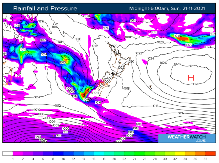
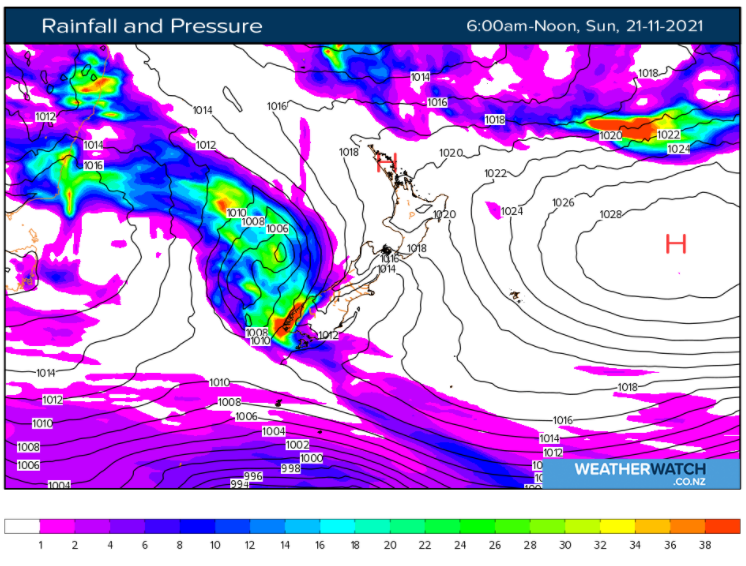
Heavy rain and deepening low pressure move into the South Island from the west today while high pressure slides a little further off the North Island, encouraging hotter weather inland with some places approaching the late 20s, maybe early 30s C.
The rain in the South Island will spill over into Nelson and Marlborough with heavy falls there too. Rain may even spread into Otago and Canterbury from the west as low pressure moves across the island later today. Canterbury looks driest of all the regions but some wet weather may pop up as the low moves in. Southland also has the risk of heavier downpours developing.
As the centre of the low moves into the lower West Coast later today, severe gales may also locally develop in that area for a time. The low is deepening and developing as it moves in so people should be aware of any MetService warnings and watches, which you can now find on our website.
See your hourly detailed hyper-local rainfall information at www.RuralWeather.co.nz to drill down deeper. Temperature trends can be found there too, along with Humidex (feels like temperature for hotter days).
The North Island is mostly dry but a few showers will pop up here and there from north to south.
View the maps below – and many more – by visiting here: www.weatherwatch.co.nz/maps-radars or clicking on the Maps and Radars tab.


Latest Video

Rain & showers this weekend, colder change next week
Some places will warm up over the next day or so as a nor’wester out of Australia moves across NZ,…
Related Articles
Rain & showers this weekend, colder change next week
Some places will warm up over the next day or so as a nor’wester out of Australia moves across NZ,…

Temperature changes for some regions ahead of heavy West Coast rain
A nor-wester is about to kick in and it’s coming from out of Australia, boosting temperatures in some regions going…

NZ 7 day forecast: Showers, temp changes and heavy West Coast rain
NZ has a fairly messy forecast over the next 7 days, but the main feature will be heavy rain on…

