Sunday’s national forecast + the outlook for Monday/Tuesday as polar change arrives (+16 Maps)
26/06/2021 4:00pm

> From the WeatherWatch archives
We’re still another day away from the polar change heading up New Zealand but temperatures will start to drop in the very south today and rain moves into northern NZ.
The rain band in the western and upper North Island will have some isolated heavy falls – but these will be patchy and rain along the West Coast continues too.
While it will be a little windy in some places, like the upper and eastern North Island, Sunday shouldn’t be as windy as Saturday was for most parts of the country.
Bursts of squallier wintry weather will move into the lower South Island tonight and overnight, gradually heading northwards over Monday with the freezing level dropping.
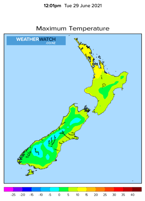
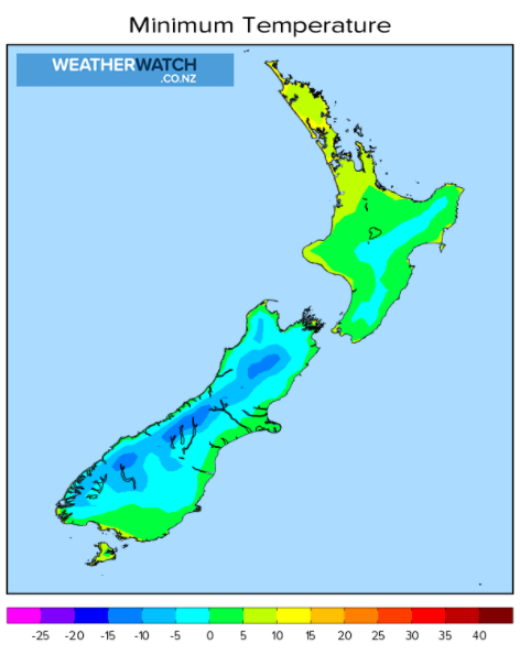
Monday and Tuesday will see the polar change arriving, bringing snow to Southland, Otago and Fiordland and into parts of Canterbury and the central North Island (and lower North Island ranges).
Sub-zero wind chill, below -10 to -15C above a few hundred metres in exposed places in the lower South Island is possible over Monday and Tuesday and wind chill of -5C is possible in sea level locations in Southland and Otago.
We’ll have more details and new maps in our next update later this morning,
- RuralWeather.co.nz has hourly windchill for the next 10 days out, the NZ Frost Forecaster and the most detailed weather data in NZ.
- WeatherWatch.co.nz now has all the latest MetService weather warnings, which you can find here.
- WeatherWatch.co.nz also has all the maps below (see the links under each map).


www.weatherwatch.co.nz/maps-radars/rain/accumulative-rainfall


www.weatherwatch.co.nz/maps-radars/temperature/maximum-temperature

www.weatherwatch.co.nz/maps-radars/temperature/maximum-temperature

www.weatherwatch.co.nz/maps-radars/temperature/maximum-temperature

www.weatherwatch.co.nz/maps-radars/temperature/minimum-temperature

www.weatherwatch.co.nz/maps-radars/temperature/minimum-temperature

www.weatherwatch.co.nz/maps-radars/temperature/below-zero

www.weatherwatch.co.nz/maps-radars/temperature/below-zero


Comments
Before you add a new comment, take note this story was published on 26 Jun 2021.


Add new comment