Sunday’s national forecast – Plenty of high pressure across NZ (+5 Maps)
30/01/2021 3:00pm

> From the WeatherWatch archives
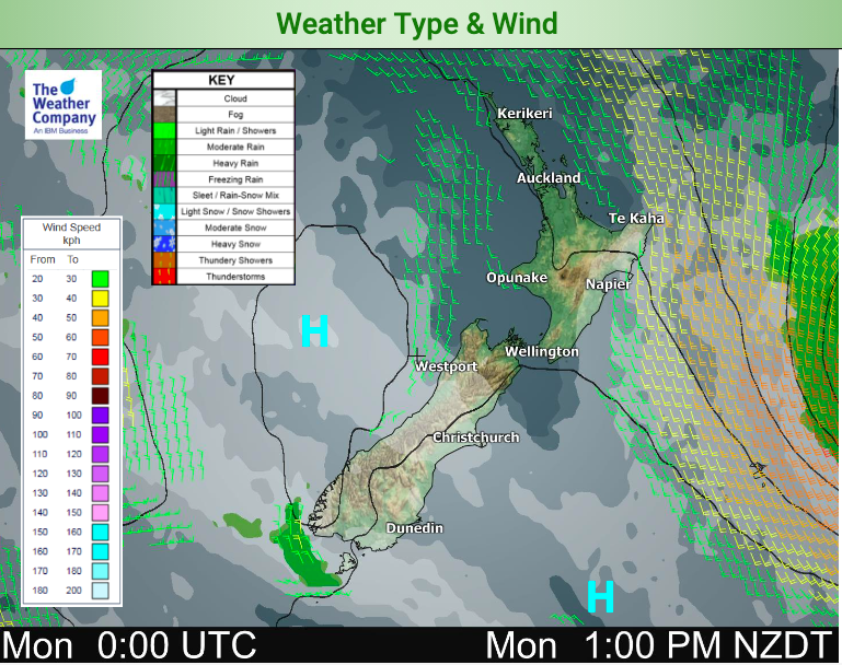
Welcome to the last day of January (that went fast). High pressure is firmly parked over New Zealand today bringing light winds and mostly dry skies.
It will be sunny through a number of regions and populated places with cloudiest weather around Northern Hawke’s Bay, Gisborne and Fiordland.
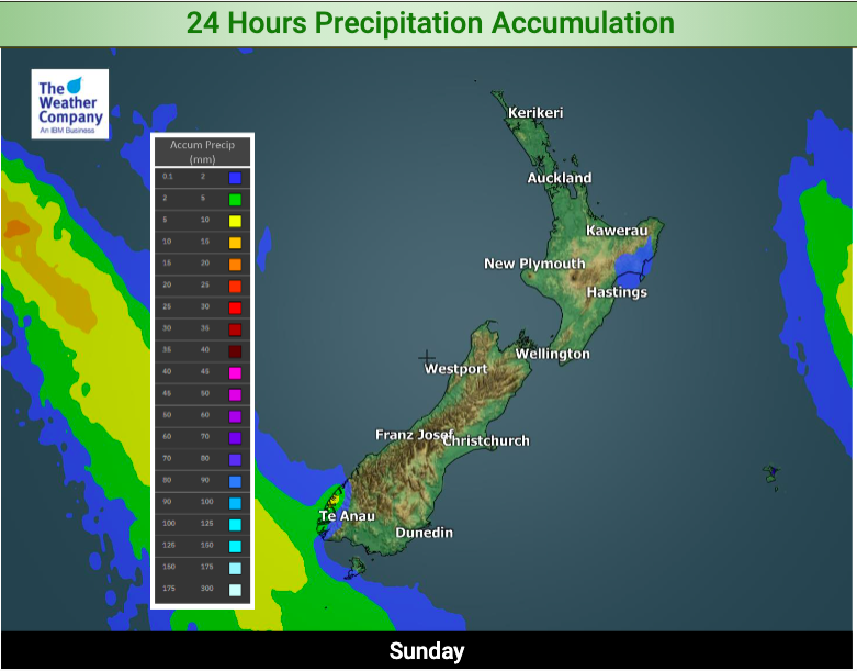
Most of NZ is dry today but showers affect similar regions such as Nothern Hawke’s Bay, Gisborne and East Cape, also Fiordland. Accumulations are not high.
Winds are light with sea breezes. Perhaps a slight south east flow in coastal Northland and Gisborne to Mahia. In the South Island a light nor’easter may hug the eastern coastline.
It’s colder than average both by day and night in Hawke’s Bay and Gisborne but a warmer than average day for many South Island regions.
Tonight will be cooler than average again across the entire North Island, due to the southerly change over the past day or so finally settling.
For much more details drill down in your LOCAL and HOURLY forecasts for wherever you are today.


Comments
Latest Video

NI low pressure, SI polar change
Low pressure will move over the upper North Island this week, bringing hit and miss pockets of heavier rain into…
Related Articles
NI low pressure, SI polar change
Low pressure will move over the upper North Island this week, bringing hit and miss pockets of heavier rain into…

Rain & showers this weekend, colder change next week
Some places will warm up over the next day or so as a nor’wester out of Australia moves across NZ,…

Temperature changes for some regions ahead of heavy West Coast rain
A nor-wester is about to kick in and it’s coming from out of Australia, boosting temperatures in some regions going…


Nicholas on 31/01/2021 1:55am
Yeah, not sure I’d describe the wind as a “Light nor Easter”. Halswell domain gusting hard out 😉
WW Forecast Team on 31/01/2021 9:43pm
Hi Nicholas, sounds like that nor’east sea breeze kicked in a little stronger than expected!
– WW