Sunday’s national forecast + another snowy cold change for some mid week (+13 maps)
3/07/2021 4:00pm

> From the WeatherWatch archives
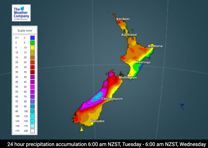
High pressure remains dominant across NZ but is starting to slide off to the east. As it does that a milder, northerly flow moves down over the country with rain setting in to the West Coast, becoming heavier in the days ahead.
But mid next week another cold shot of air moves up the South Island bringing low level snow flurries around Southland and biting wind chill. WeatherWatch.co.nz is already receiving photos of lambs being born (early!) and so for those farmers please be away wind chill will be below zero mid this week for a time. The upcoming cold change isn’t as powerful as the polar change last week but will still make for a bleak Wednesday and/or Thursday in some places.
Sunday is a mostly settled day with frosts in some places this morning and again tonight in the north.
Check your local forecast for more details at WeatherWatch.co.nz and RuralWeather.co.nz.


Latest Video

More heavy rain, snow – but large dry areas, especially as we go into the long weekend
Heavy rain will continue for parts of Canterbury and Marlborough over the next day or two and it will gradually…
Related Articles
More heavy rain, snow – but large dry areas, especially as we go into the long weekend
Heavy rain will continue for parts of Canterbury and Marlborough over the next day or two and it will gradually…

Large low brings rain, downpours & some snow – gets colder as the week progresses
Low pressure will cross the upper North Island in the days ahead and that set-up actually pushes more heavy rain…

WeatherWatch App launches real-time local lightning tracker!
A bolt out of the blue! WeatherWatch has launched a live, real-time lightning tracker, enabling Kiwis to gain access to data provided by the…

