Sunday’s national forecast – A thunderstorm in the north, gales in the south (+12 Maps)
9/01/2021 3:00pm

> From the WeatherWatch archives
For most of NZ today the weather is fairly settled, but a low in the Southern Ocean will put the squeeze on the winds through the lower South Island.
Meanwhile, daytime heating in the north eastern North Island may see an isolated inland thunderstorm, mainly around eastern Bay of Plenty and perhaps the Gisborne Ranges.
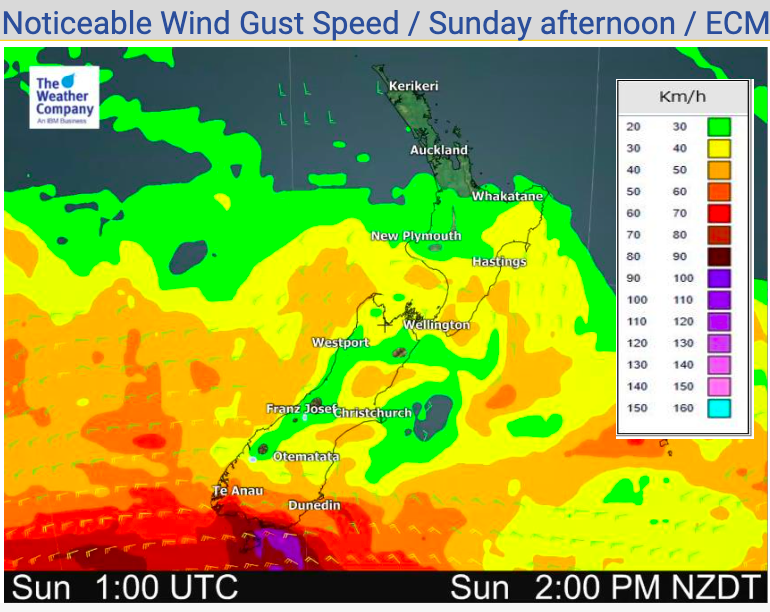
Gales will brush coastal Southland and Otago with winds 90 to 100km/h possible for some. For those camping this is definitely strong enough to rip tents and awnings, so be prepared! It may also make driving hazardous, for those heading home – or about to head away.
Most of NZ has average to above average temperatures today – but yet another eastern South Island cool down is coming on Monday.
See your HOURLY LOCAL forecasts for much more detail.


Latest Video

NI low pressure, SI polar change
Low pressure will move over the upper North Island this week, bringing hit and miss pockets of heavier rain into…
Related Articles
NI low pressure, SI polar change
Low pressure will move over the upper North Island this week, bringing hit and miss pockets of heavier rain into…

Rain & showers this weekend, colder change next week
Some places will warm up over the next day or so as a nor’wester out of Australia moves across NZ,…

Temperature changes for some regions ahead of heavy West Coast rain
A nor-wester is about to kick in and it’s coming from out of Australia, boosting temperatures in some regions going…

