Sunday’s national forecast – a messy set up across NZ (+5 Maps)
27/03/2021 3:00pm

> From the WeatherWatch archives
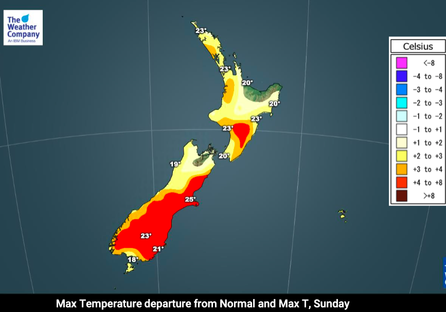
A weak rain band lies along the eastern Tasman Sea/western side of NZ with some heavy falls on the West Coast and perhaps Mt Taranaki, but dry or mainly dry elsewhere with a few showers – especially dry in the east.
A mild northerly flow will be enhanced as north to north west winds move over the ranges, pushing temperatures up in the east. But for those in the very north, despite fairly mild overnight temperatures, the breeze by day off the sea will make for near normal temperatures and cooler in the wind itself.
See your LOCAL and HOURLY forecast for more details and we’ll have more news, maps and a video update out on Monday.


Latest Video

Matariki, the long weekend + the outlook for next week
Wet weather and cloud continues along the eastern side of the country with the heaviest rain now moving into northern…
Related Articles
Matariki, the long weekend + the outlook for next week
Wet weather and cloud continues along the eastern side of the country with the heaviest rain now moving into northern…

More eastern rain, but a drier long weekend coming
Rain continues today along the eastern South Island and lower North Island, coming in from the east with heavy falls….

More heavy rain, snow – but large dry areas, especially as we go into the long weekend
Heavy rain will continue for parts of Canterbury and Marlborough over the next day or two and it will gradually…

