Sunday’s forecast: Heavy rain in the upper SI falls apart as it moves into lower NI (+7 Maps)
27/11/2021 3:00pm

> From the WeatherWatch archives
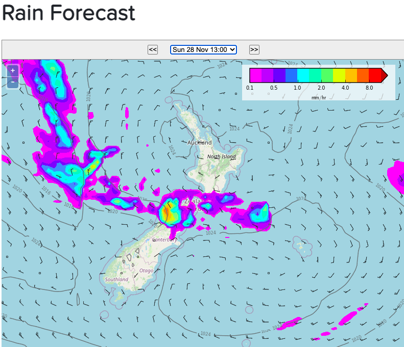
Heavy rain continues today around the north west corner of the South Island but eases further south as the front moves into the lower North Island and falls apart.
Dry parts of Southern Wairarapa will likely get some wet weather later today – but will be patchy.
Heavy rain, more localised, will remain in the upper West Coast tonight with rain turning to lighter showers on Monday.
Elsewhere the weather is mostly dry.
Keep up to date with the HOURLY forecasts at WeatherWatch.co.nz and RuralWeather.co.nz to drill down further.
All the maps below can be found here: www.weatherwatch.co.nz/maps-radars
Have a fantastic Sunday – the last Sunday for November 2021!


Latest Video

Wintry weather coming: Snow, rain, wind & sunshine
A cold front is moving into NZ from Friday to Sunday with low pressure developing west of NZ and then…
Related Articles

Polar airflow + northern low = pockets of heavy rain & snow
A colder change is coming – and so too is a large low which will develop and grow over northern…
Wintry weather coming: Snow, rain, wind & sunshine
A cold front is moving into NZ from Friday to Sunday with low pressure developing west of NZ and then…

ClimateWatch: JULY outlook & what El Niño means for NZ
El Niño is officially here and still getting stronger in the months ahead, but it’s harder to notice its effects…

