Sunday’s forecast: From southern severe frosts to northern severe gales & rain (+13 Maps)
10/07/2021 4:00pm

> From the WeatherWatch archives
While high pressure is expanding across NZ, the upper North Island has low pressure moving in with a windy ‘squash zone’ of air pressure creating gales, especially in coastal parts of the north and north east.
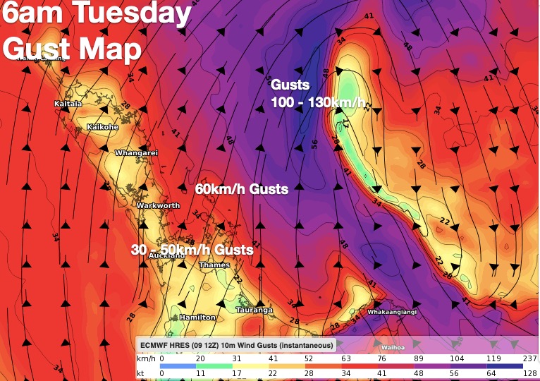
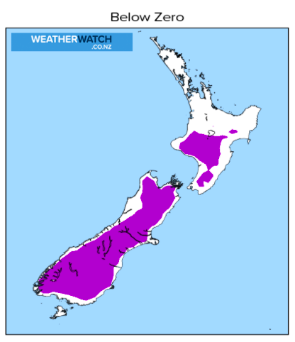
While severe frosts are forecast for the South Island’s interior tonight (-5C to -12C possible in some highland areas) it’s severe gales that are expected offshore from Northland and Auckland overnight tonight and across Monday.
Monday is the main day for windy weather in northern NZ.
The latest rainfall map shows and increased chance of rain in Northland and the Far North – which will be welcome by those who need rain.
Windiest weather will be in eastern Northland and northern Auckland along the eastern coastline. While gales are possible in Auckland city for a time on Monday it’s Great Barrier Island that is actually most exposed – and then later on it’s East Cape, Gisborne and eastern Bay of Plenty exposed to gusty winds and gales.
Remember, our forecasts show hourly wind speed and over at RuralWeather.co.nz you can see wind GUSTS in graph form, to help you understand your wind risks – but also localised rainfall totals.
Temperatures also drop today in the eastern North Island, setting off a colder few days ahead for places like Hawke’s Bay.
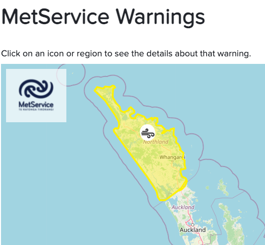
All official MetService warnings and watches can now be found LIVE right here at WeatherWatch.co.nz – you can view them here.


https://www.weatherwatch.co.nz/maps-radars/temperature/maximum-temperature

https://www.weatherwatch.co.nz/maps-radars/temperature/minimum-temperature

https://www.weatherwatch.co.nz/maps-radars/temperature/maximum-temperature
https://www.weatherwatch.co.nz/maps-radars/temperature/below-zero
Latest Video

Snow, rain showers & cold polar southerlies set to return
Friday will be a wintry day across NZ as the next cold front arrives, bringing snow to lower levels of…
Related Articles
Snow, rain showers & cold polar southerlies set to return
Friday will be a wintry day across NZ as the next cold front arrives, bringing snow to lower levels of…

Frosts, late week rain & another cold weekend coming
High pressure will cross NZ over the next few days meaning more cold nights/mornings with frosts, but a nor’wester will…

NZ: Cold & windy, then calm & frosty
Downpours, some squally with the chance of thunderstorms and even small tornadoes are possible for parts of NZ over Friday…

