
> From the WeatherWatch archives
Autumn is finally waking up with a proper blast of rain, wind and even snow this weekend and into the start of next week.
TEMPERATURES:
As we head into the weekend the weather in many places will be dry and warmer than average, with many places enjoying a warm Saturday too.
However by Sunday colder air will start moving up the South Island and by Monday many places will be cool or cold, with highs in the lower South Island struggling to reach double digits.

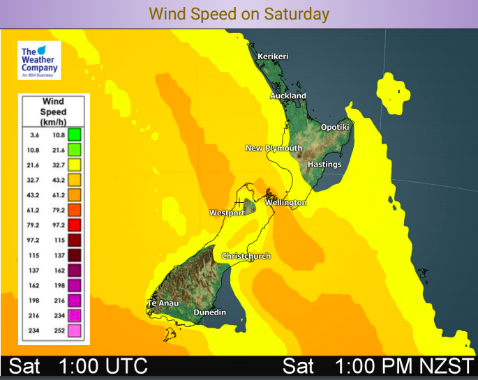
WINDS:
High pressure covers many places for Friday but it is slipping away with strong winds developing later today in the south and heading up to Wellington and the lower North Island on Saturday. Gales are possible in exposed/usual areas.
Most places will have northerly quarter winds, especially nor’westers. A colder south to sou’west change arrives late Sunday and over Monday.
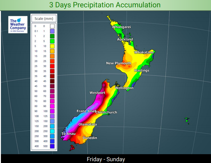
RAIN:
Very heavy rain on the West Coast. Watch for possible slips and flooding with rainfall totals exceeding 200 to 250mm.
Elsewhere the rainfall totals aren’t so big, with dry parts of the North Island perhaps only getting 5 to 10mm over the next few days.
– WeatherWatch.co.nz
Latest Video

NZ: 8 Day outlook as gales & rain ease, high pressure builds
Damaging wind gusts and heavy rain will continue to affect some parts of the North Island and brushing Marlborough today…
Related Articles
NZ: 8 Day outlook as gales & rain ease, high pressure builds
Damaging wind gusts and heavy rain will continue to affect some parts of the North Island and brushing Marlborough today…

Pockets of hit & miss heavy rain, snow moves northwards
Low pressure continues to slowly move across the upper North Island and for some that will bring the sun out,…

Slow go for northern low & southern cold
For the next few days low pressure will crawl over the upper North Island, driving in rain as far south…

