> From the WeatherWatch archives
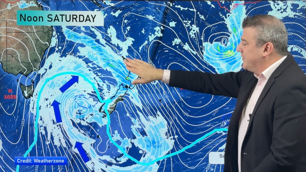
The first of round of rain warnings have today been issued by the government forecaster as a front explodes into life in the Tasman Sea.
WeatherWatch.co.nz head weather analyst Philip Duncan says the front has grown rapidly over the past 24 hours as sub-tropical air fires things up. “This front started off as a blip of cloud on Sunday and in 48 hours is has rapidly exploded into life and takes up muc of the Tasman Sea”.
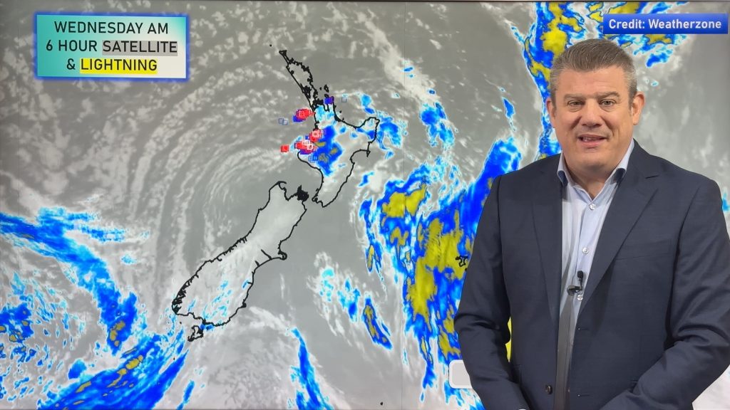
Mr Duncan says it is one of the most dramatic looking fronts this year. “The satellite map shows a huge mass of large clouds in dramatic contrast to the mostly clear skies on either side”.
He says the front stretches the length of the Tasman Sea from the Coral Sea in the sub-tropics down to the Southern Ocean near New Zealand.
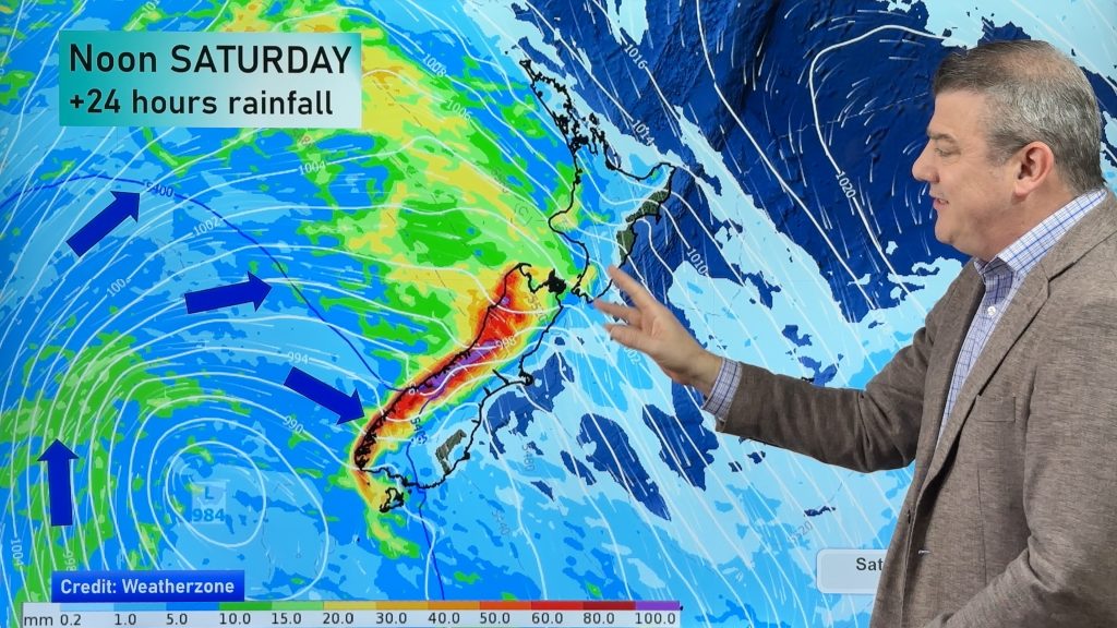
Several rain warnings have today been issued (see below) and more are expected as the heavy rain, held up by a large high, slowly moves towards the North Island.
The West Coast will be the first to get the rain, being our western most region. “The rain will set in across the afternoon and evening along the West Coast then head into Nelson tonight. During Wednesday the rain band will slowly move into the North Island with sustained heavy rain, torrential at times, expected through central and some northern areas by late Wednesday and into Thursday”.
Mr Duncan says the rain will be slow moving and could cause flooding in some regions.
WeatherWatch.co.nz advises farmers in all flood prone areas to move stock to higher ground as the rain clouds move in.
Heavy rain in the Tararua and Hawkes Bay ranges may spillover to the east coast however recently flooded parts of Hawkes Bay aren’t going to take a direct hit from this rain storm.
– WeatherWatch.co.nz
Government warnings issued via Metservice – valid as of 1:58pm Tuesday – PLEASE NOTE the warnings on this page will not be updated.
Wairarapa
Heavy Rain Warning, Areas Affected: The Tararua Range Heavy rain is expected to develop Wednesday evening. In the 18 hours from 9pm Wednesday to 3pm Thursday, expect 80 to 120mm of rain. Peak intensities of 20mm/hr Thursday morning.
Taranaki
Heavy Rain Warning, Areas Affected: Mount Taranaki Heavy rain is expected to develop Wednesday evening. In the 21 hours from 9pm Wednesday to 6pm Thursday, expect 100 to 150mm of rain. Peak intensities of 20mm/hr Thursday morning.
Wanganui
No warning in force for this location
Manawatu
Heavy Rain Warning, Areas Affected: The Tararua Range Heavy rain is expected to develop Wednesday evening. In the 18 hours from 9pm Wednesday to 3pm Thursday, expect 80 to 120mm of rain. Peak intensities of 20mm/hr Thursday morning.
Horowhenua
Heavy Rain Warning, Areas Affected: The Tararua Range Heavy rain is expected to develop Wednesday evening. In the 18 hours from 9pm Wednesday to 3pm Thursday, expect 80 to 120mm of rain. Peak intensities of 20mm/hr Thursday morning.
Wellington
Heavy Rain Warning, Areas Affected: The Tararua Range Heavy rain is expected to develop Wednesday evening. In the 18 hours from 9pm Wednesday to 3pm Thursday, expect 80 to 120mm of rain. Peak intensities of 20mm/hr Thursday morning.
Marlborough
Heavy Rain Warning, Areas Affected: The Richmond Range Heavy rain is expected to develop Wednesday morning. In the 24 hours from 6am Wednesday to 6am Thursday, expect 100 to 150mm of rain. Peak intensities of 25mm/hr from late Wednesday afternoon to early Thursday morning.
Nelson
Heavy Rain Warning, Areas Affected: The ranges of western Nelson Northerly rain is expected to develop Tuesday evening and become heavy Wednesday morning. In the 27 hours from 3am Wednesday to 6am Thursday expect 150 to 200mm of rain, and possibly as much as 250mm of rain on some of the higher peaks. Peak intensities of 25 to 30mm/hr expected Wednesday morning and afternoon. Heavy Rain Warning, Areas Affected: The Richmond RangeHeavy rain is expected to develop Wednesday morning. In the 24 hours from 6am Wednesday to 6am Thursday, expect 100 to 150mm of rain. Peak intensities of 25mm/hr from late Wednesday afternoon to early Thursday morning.
Nelson Lakes
Heavy Rain Warning, Areas Affected: The ranges of western Nelson Northerly rain is expected to develop Tuesday evening and become heavy Wednesday morning. In the 27 hours from 3am Wednesday to 6am Thursday expect 150 to 200mm of rain, and possibly as much as 250mm of rain on some of the higher peaks. Peak intensities of 25 to 30mm/hr expected Wednesday morning and afternoon. Heavy Rain Warning, Areas Affected: The Richmond RangeHeavy rain is expected to develop Wednesday morning. In the 24 hours from 6am Wednesday to 6am Thursday, expect 100 to 150mm of rain. Peak intensities of 25mm/hr from late Wednesday afternoon to early Thursday morning.
Buller
Heavy Rain Warning, Areas Affected: The ranges of Buller Rain is expected to develop Tuesday evening and become heavy Wednesday morning. In the 24 hours from 3am Wednesday to 3am Thursday, expect 100 to 150mm of rain. Peak intensities of 25 to 30mm/hr expected Wednesday morning and afternoon.
Westland
Heavy Rain Warning, Areas Affected: Ranges of Fiordland and South Westland between Doubtful Sound and Haast Pass Rain is expected to become heavy Tuesday evening. In the 12 hours from 5pm Tuesday, expect 70 to 120mm of rain. Heaviest falls are likely overnight Tuesday with rates up to about 20mm/hr. Heavy Rain Warning, Areas Affected: Ranges of Westland between HaastPass and Otira Rain is expected to become heavy overnight Tuesday. In the 12 hours from 10pm Tuesday, expect 100 to 150mm of rain. Heaviest falls are likely early Wednesday morning with rates up to about 30mm/hr.
Fiordland
Heavy Rain Warning, Areas Affected: Ranges of Fiordland and South Westland between Doubtful Sound and Haast Pass Rain is expected to become heavy Tuesday evening. In the 12 hours from 5pm Tuesday, expect 70 to 120mm of rain. Heaviest falls are likely overnight Tuesday with rates up to about 20mm/hr.
Comments
Before you add a new comment, take note this story was published on 24 May 2011.


Add new comment
Guest on 24/05/2011 2:45am
Any chance of thunder storms with this event, as i see on the maps there is warm air coming from the tasman and cold air coming from the south.. Or have i got this totally wrong lol?
Reply
WW Forecast Team on 24/05/2011 4:06am
No you’re bang on with your prediction! Definitely a chance for thunderstorms. As we’ve learnt in the past we can have all the ingredients but not actually get thunder – we think there is a moderate to high risk of ISOLATED thunderstorms. This means, for example, Auckland may get a rumble – or it may be Northland or Bay of Plenty. They are tricky to forecast in advance here in NZ but we certainly have the conditions for it – and our data has been confirming thunderstorms for 3 updates in a row now for Northland, Auckland, Taranaki, Bay of Plenty and West Coast. Highest risk for most North Island regions appears to be Thursday – so we’ll closely monitor.
– WeatherWatch.co.nz
Reply
Ross on 24/05/2011 2:06am
http://www.goes.noaa.gov/sohemi/sohemiloops/shirgmscol.html
Reply
celtickiwi on 24/05/2011 6:56am
Aw wow Ross! That is impressive, thanks for the link 🙂
Reply