Severe weather for upper North Island: Gales & Heavy rain move in Sunday PM/Monday AM (+8 Maps)
30/05/2020 8:46pm

> From the WeatherWatch archives
A large high is expanding east of NZ while a weak low moves in – the combination of this powerful high and small low means a sub-tropical nor’easter is developing – a set up that sees rain clouds funnel down from the moisture-rich sub-tropics and directly into northern and north eastern New Zealand.
The small low to the north is weak but is acting like a small ‘cog’, helping to pull more rain in – and also putting a little more local squeeze on the already significant widespread squash zone forming around this giant high expanding to our east right now. (The same high bringing sunny, frosty, weather to the South Island).
RAIN:
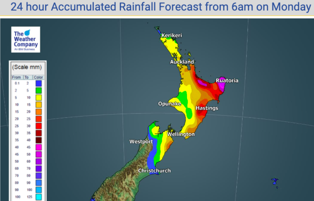
Rain will line up with certain eastern parts of the upper North Island later, being fed by the blocking high to the east which also stops the rain clouds from moving through – increasing rainfall totals to flood and slip risk criteria for some today. (Keep up to date with tax funded warnings from Government forecaster MetService). In some spots over 100mm is possible, falling within a day. So yes, the high is both producing the rain and stopping it from moving by quickly.
GALES:
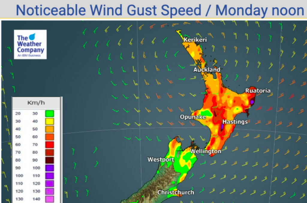
Winds will also be strong enough to cut power in some exposed upper North Island areas for a time tonight and overnight. Eastern Waikato has the highest risk overnight tonight/Monday morning with gusts over 120km/h possible on the western side of the Kaimai and Coromandel Peninsula. The Hauraki Gulf, Great Barrier Island and north of Auckland may see gusts to 80 or 90km/h with isolated power cuts possible.
Winds peak overnight tonight/Monday morning – and ease into Monday as they slide down the North Island in a similar fashion and peak winds start to drop.


- WeatherWatch.co.nz – For news, maps, video and hourly forecasts
- www.RuralWeather.co.nz – For the world’s largest weather data site for your local part of NZ!
Comments
Before you add a new comment, take note this story was published on 30 May 2020.


Add new comment