Saturday’s national forecast – Rain moves into the south (+6 Maps)
13/11/2020 3:00pm

> From the WeatherWatch archives
High pressure continues to cover the North Island but is slipping off some of the South Island.
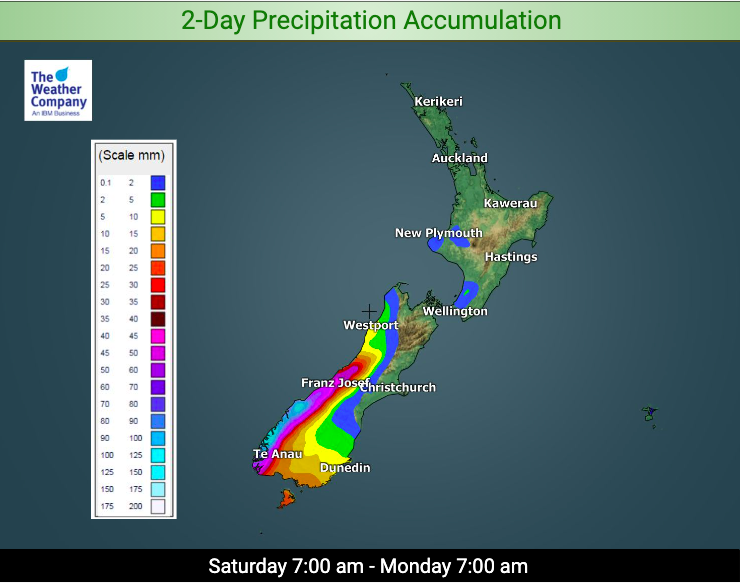
This process encourages rain in Fiordland (and surrounds) to move northwards a little – along with a windy nor’wester. Southland and South Westland are also expected to get some rain.
Winds will be strong through Wellington and Cook Strait and in exposed alpine areas.
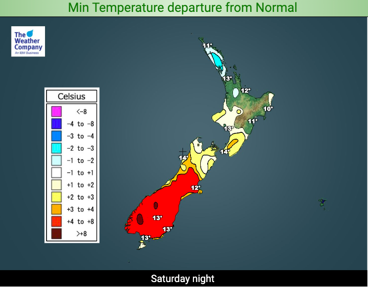
Temperatures are again above average in most places.
Here are the regional forecasts for Saturday
Northland, Auckland, Waikato & Bay Of Plenty
Light variable winds or a light westerly under high pressure. A mix of sunny and cloudy periods, although mostly sunny in Bay of Plenty and other eastern areas.
Highs: 20 – 24
Western North Island (including Central North Island)
Cloudy at times with west to north west winds. Might be a coastal shower in the very lower North Island.
Highs: 17 – 20
Eastern North Island
Sunny with West to North West winds. Hottest inland.
Highs: 20 – 27
Wellington
Brisk north to north west winds and passing clouds.
High: 17 or 18
Marlborough & Nelson
West to north west winds and mostly sunny and warm.
Highs: 21 – 26
Canterbury
A sunny warm to hot day with nor’westers. Coolest in the mountains and high country where it may also be a little cloudier at times.
Highs: 16 – 28
West Coast
North to north west winds and clouds increasing. Might be a few showers otherwise a mainly dry day.
Highs: 16 – 19
Southland & Otago
A mix of sun and cloud with north to north west winds. Showers turning to rain Fiordland and a few showers possible elsewhere.
Highs: 17-22
THE MAPS


Latest Video

Slow moving low to track over northern NZ
A low pressure zone will slowly cross the North Island over the coming days, bringing hit and miss pockets of…
Related Articles
Slow moving low to track over northern NZ
A low pressure zone will slowly cross the North Island over the coming days, bringing hit and miss pockets of…

NI low pressure, SI polar change
Low pressure will move over the upper North Island this week, bringing hit and miss pockets of heavier rain into…

Rain & showers this weekend, colder change next week
Some places will warm up over the next day or so as a nor’wester out of Australia moves across NZ,…

