Saturday’s national forecast – Good precipitation in the far north
18/03/2022 11:01am
> From the WeatherWatch archives
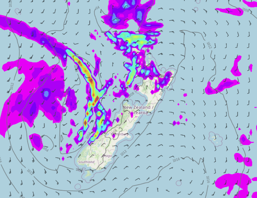
A northeasterly airflow lies over New Zealand today, there are showers for the West Coast and northeast of the North Island, a few isolated heavy falls are even possible for Northland and Auckland.
Northland, Auckland, Waikato & Bay Of Plenty
Mostly cloudy with patchy rain or showers, chance of a few isolated heavy falls for Auckland and Northland. Northeasterly winds freshen later in the day.
Highs: 20-23
Western North Island (including Central North Island)
Morning low cloud or fog then mostly sunny, high cloud from afternoon. Light winds.
Highs: 18-22
Eastern North Island
Partly cloudy although Wairarapa may be mostly sunny, east to northeasterly winds.
Highs: 19-21
Wellington
Mostly sunny, a touch of high cloud from afternoon. Winds from the northeast may die out and becoming light and variable.
Highs: 18-21
Marlborough & Nelson
A mix of sun and cloud. Afternoon northeasterly winds for Marlborough, afternoon northerlies for Nelson.
Highs: 18-20
Canterbury
Morning sun then cloud thickening up a little, drizzle possible overnight. Breezy east to northeasterly winds.
Highs: 17-19
West Coast
Mostly cloudy with patchy rain or showers, rain may be more persistent in the morning for South Westland then easing. Northeasterly winds.
Highs: 16-19
Southland & Otago
Sunny areas and some high cloud after morning lower level cloud breaks away. Coastal Otago has a mostly cloudy day with a drizzle patch possible. East to northeasterly winds.
Highs: 17-20
Latest Video

More heavy rain, snow – but large dry areas, especially as we go into the long weekend
Heavy rain will continue for parts of Canterbury and Marlborough over the next day or two and it will gradually…
Related Articles
More heavy rain, snow – but large dry areas, especially as we go into the long weekend
Heavy rain will continue for parts of Canterbury and Marlborough over the next day or two and it will gradually…

Large low brings rain, downpours & some snow – gets colder as the week progresses
Low pressure will cross the upper North Island in the days ahead and that set-up actually pushes more heavy rain…

WeatherWatch App launches real-time local lightning tracker!
A bolt out of the blue! WeatherWatch has launched a live, real-time lightning tracker, enabling Kiwis to gain access to data provided by the…

