> From the WeatherWatch archives
An area of low pressure moves over New Zealand pushing in from the Tasman Sea bringing unsettled weather to many regions today.
RainWatch is a series during the weekdays, giving a snapshot about where around New Zealand areas of precipitation may affect your day.
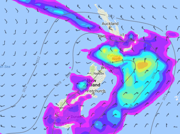
For the upper North Island we see areas of rain or showers mainly Auckland southwards, easing a tad from afternoon. Northland stays mainly dry during the day, just a few late evening showers.
Showers turn to rain in the morning for the lower North Island in the west, rain may be heavy at times then easing in the evening.
The Wairarapa sees the odd shower then areas of rain develop late morning, clearing in the evening. Further north there may just be the odd spot of rain, especially around midday.
Rain for the West Coast of the South Island eases to showers in the afternoon. Some morning rain for Canterbury and Marlborough then drying out, in the evening a few showers move into Canterbury up to about Banks Peninsula. Showers may be heavy about South Canterbury as they move in.
Some morning rain for Otago and Southland, perhaps it may dry out for a time after midday then showers develop mid to late afternoon, possibly heavy with thunderstorms about coastal Otago.

WeatherWatch.co.nz
Image – Tuesday 4pm, 3rd January 2017 rain / MSLP map – weathermap.co.nz
Comments
Before you add a new comment, take note this story was published on 2 Jan 2017.


Add new comment