RainWatch: Next 7 days rain & snow across New Zealand (+8 Maps)
27/12/2020 9:51pm

> From the WeatherWatch archives
High pressure crosses NZ for the final days of 2020 while the start of 2021 may have low pressure.
This set up means some normal rainfall will come in to various regions, however for the most part a drier theme is either returning or staying put.
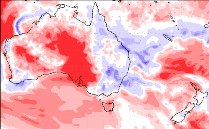
Blue = Wetter than average, White = Normal, Red = Drier than usual.
Data with thanks to the US Government.
Rainfall totals this week show 40 to 70mm of rain may fall around parts of the South Island (over the next 7 days) while the North Island has smaller totals, especially northern areas where it’s been drier than normal now for almost two years.
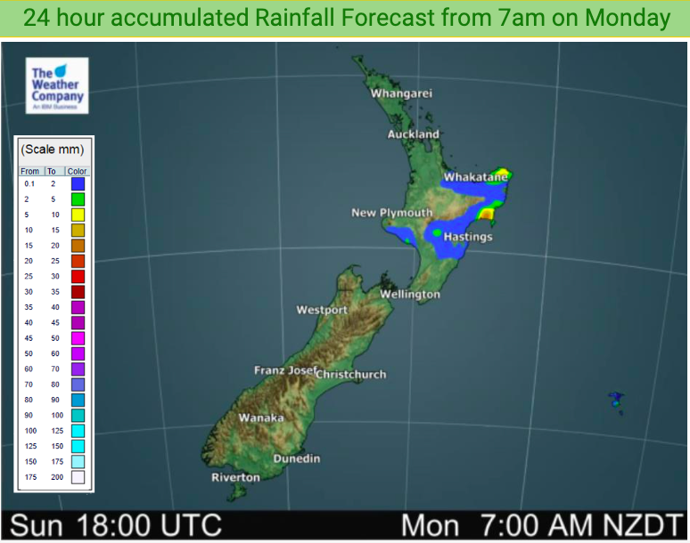
When 2021 kicks off on Friday and this weekend a weak area of low pressure may form over New Zealand bringing some wet weather and lifting totals. It’s still a bit of a messy set up, our rain forecast maps are the best are showing how it visually looks – and to make sense of it locally use the HOURLY forecasts at WeatherWatch and RuralWeather.co.nz.


Latest Video

More eastern rain, but a drier long weekend coming
Rain continues today along the eastern South Island and lower North Island, coming in from the east with heavy falls….
Related Articles
More eastern rain, but a drier long weekend coming
Rain continues today along the eastern South Island and lower North Island, coming in from the east with heavy falls….

More heavy rain, snow – but large dry areas, especially as we go into the long weekend
Heavy rain will continue for parts of Canterbury and Marlborough over the next day or two and it will gradually…

Large low brings rain, downpours & some snow – gets colder as the week progresses
Low pressure will cross the upper North Island in the days ahead and that set-up actually pushes more heavy rain…

