Rainfall maps for Thursday, Friday & Five Days accumulation (+3 Maps)
11/12/2019 7:13pm

> From the WeatherWatch archives
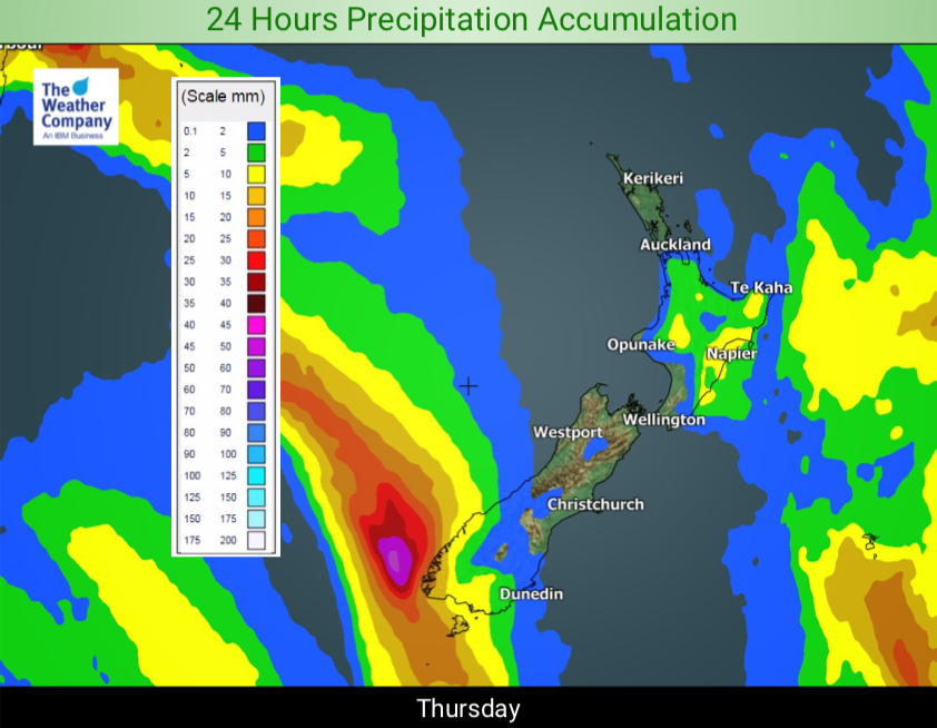
Patchy ongoing light to moderate rain over the north eastern North Island will linger through Thursday. Some isolated heavy spells are possible over Hawkes Bay and Gisborne but mostly light.
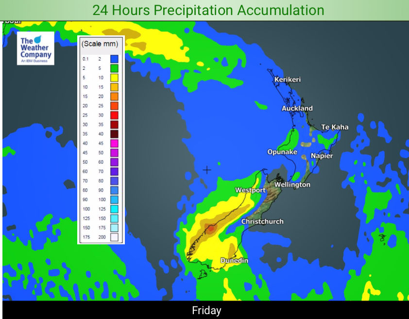
A cold front is approaching the West Coast and will pass over the South Island on Friday, then fall apart over the North Island on Saturday.
The cold front will drag temperatures lower mainly over the South Island on Saturday. Max temperature in Christchurch will be in the middle of 20s on Friday and it will be in the upper teens on Saturday.
A brisk low pressure system will pass over the country next Tuesday.
The best chance of rainfall for the next 5 days will be over Fiordland and southern West Coast, with totals of 50 mm –
locally 150mm.

– WeatherWatch.co.nz
Latest Video

26/06/2026 12:12am
NZ: 8 Day outlook as gales & rain ease, high pressure builds
Damaging wind gusts and heavy rain will continue to affect some parts of the North Island and brushing Marlborough today…
Related Articles
26/06/2026 12:12am
NZ: 8 Day outlook as gales & rain ease, high pressure builds
Damaging wind gusts and heavy rain will continue to affect some parts of the North Island and brushing Marlborough today…

25/06/2026 12:15am
Pockets of hit & miss heavy rain, snow moves northwards
Low pressure continues to slowly move across the upper North Island and for some that will bring the sun out,…

23/06/2026 11:55pm
Slow go for northern low & southern cold
For the next few days low pressure will crawl over the upper North Island, driving in rain as far south…

