Rain Maps (x2): How much did all those thunderstorms dump last week? What more is coming?
17/12/2018 9:54pm

> From the WeatherWatch archives
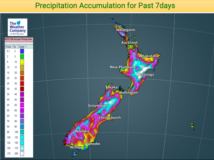
New Zealand was affected by tens of thousands of thunderstorms last week and all of them delivered significant heavy downpours inland, some with flash flooding.
The map below clearly shows you where the bulk of the daytime downpours formed – it’s a helpful map as it shows why some coastal fringes in New Zealand are drier than average while inland areas are not.
More rain is coming in the days ahead, with at least two low pressure systems crossing New Zealand between Wednesday and Saturday.

– WeatherWatch.co.nz
Latest Video

Cold weekend, frosts return with high pressure, then a low late next week
The subantarctic airflow spreads over NZ today/tonight and into Saturday, dropping temperatures nationwide. Snow flurries are possible today to lower…
Related Articles
Cold weekend, frosts return with high pressure, then a low late next week
The subantarctic airflow spreads over NZ today/tonight and into Saturday, dropping temperatures nationwide. Snow flurries are possible today to lower…

Wintry burst of weather: Snow, squally showers then sunshine & frosts
A polar change (another one!) arrives on Friday for the South Island and goes nationwide on Saturday, leaving NZ under…

Antarctic southerly for parts of NZ Fri & Sat
For the first time this year a southerly from off Antarctica is heading towards the South Island, followed by more…

