
> From the WeatherWatch archives
A developed low is located to the north of North Island and is today slowly starting to weaken. Though its track will not cross the country’s landmass directly, an associated front has brought patchy rain over the upper North Island since Tuesday.
Any rain today is much lighter – just a few spits for some, or patchy showers for others. Coastal Bay of Plenty and Gisborne/East Cape have the highest chances of rain today and possibly and isolated heavier fall.
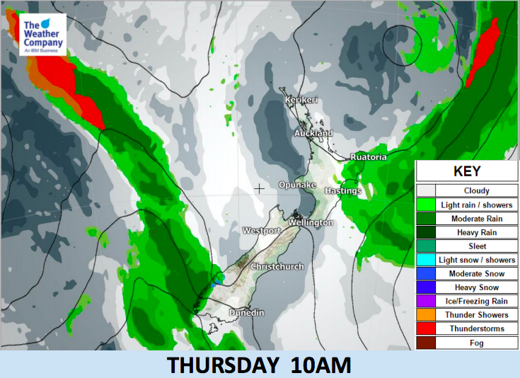
Another cold front will sweep the western coastline of the South Island from Thursday morning to Friday morning. Rain accumulation in Southland and the West Coast will be around 30 mm at most. Some snow accumulation over the Southern Alps is forecast but not a major event.


– WeatherWatch.co.nz
Latest Video

Cold weekend, frosts return with high pressure, then a low late next week
The subantarctic airflow spreads over NZ today/tonight and into Saturday, dropping temperatures nationwide. Snow flurries are possible today to lower…
Related Articles
Cold weekend, frosts return with high pressure, then a low late next week
The subantarctic airflow spreads over NZ today/tonight and into Saturday, dropping temperatures nationwide. Snow flurries are possible today to lower…

Wintry burst of weather: Snow, squally showers then sunshine & frosts
A polar change (another one!) arrives on Friday for the South Island and goes nationwide on Saturday, leaving NZ under…

Antarctic southerly for parts of NZ Fri & Sat
For the first time this year a southerly from off Antarctica is heading towards the South Island, followed by more…

