Past 7 days rainfall + How much rain is coming this week (+5 Maps)
9/12/2019 1:31am

> From the WeatherWatch archives
Some parts of NZ are drenched others are much drier and in need of rain. A several day deluge has now cleared the West Coast with a much drier week on the way for them – but another burst of heavy rain is expected late week (nothing like what has just fallen though).
Meanwhile dry parts of the upper and eastern North Island had hit and miss relief over the weekend. Sunday saw a number of significant downpours drenching parts of Northland and Waikato while other parts of these regions – and a large portion of Auckland – missed out on widespread downpours.
Northern NZ has been in a rainfall deficit for most of 2019 and lately it’s been hotter and drier than normal. WeatherWatch.co.nz says this is due to northern NZ catching some of Australia’s big dry (mainly caused by high pressure drifting over northern NZ or blocking rainmakers from northern NZ).
Eastern parts of the North Island are also drying out fast with several 30+ degree days in recent weeks and plenty of windy westerlies and sun.
Over the next week the departure from normal rainfall map (below) shows much of NZ leaning drier than usual, despite a few downpours and another front moving in late week.
DEPARTURE FROM NORMAL RAINFAL OVER THE NEXT 7 DAYS:
Red = Drier than normal. White = Average rainfall for week 2 of December. Blue = Wetter than usual. Data: US Govt.
HOW MUCH HAS ALREADY FALLEN?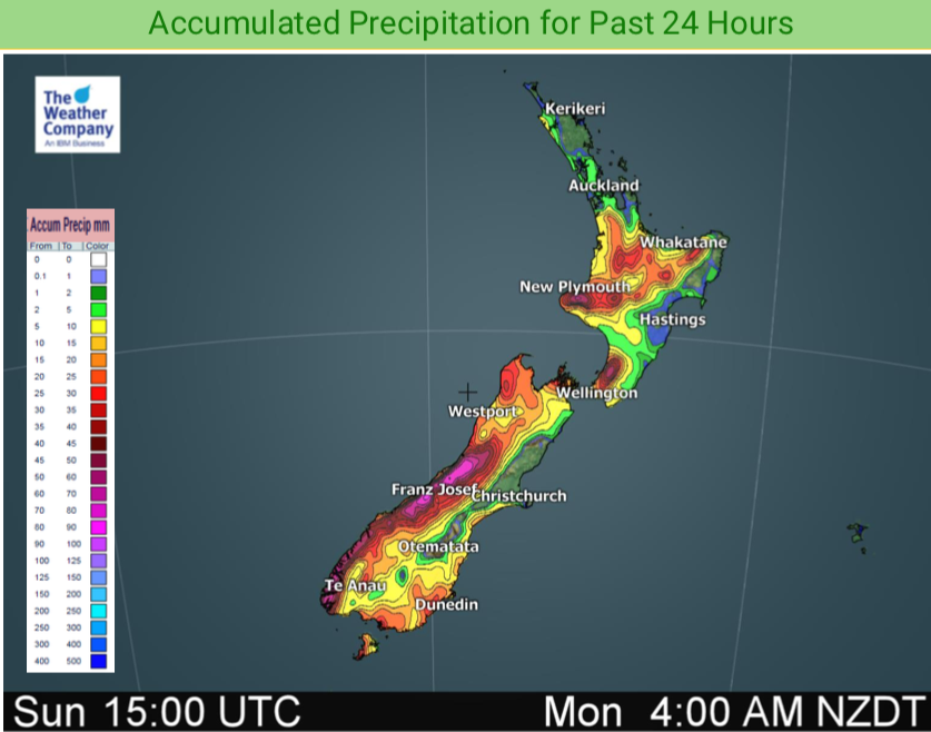

HOW MUCH RAIN IS COMING UP?
NEXT 72 HOURS (to 7am Thursday)
HOW MUCH RAIN IS COMING UP?
NEXT 5 DAYS (to 7am Saturday)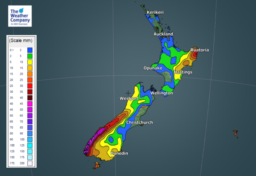
– WeatherWatch.co.nz
Latest Video

Cold weekend, frosts return with high pressure, then a low late next week
The subantarctic airflow spreads over NZ today/tonight and into Saturday, dropping temperatures nationwide. Snow flurries are possible today to lower…
Related Articles
Cold weekend, frosts return with high pressure, then a low late next week
The subantarctic airflow spreads over NZ today/tonight and into Saturday, dropping temperatures nationwide. Snow flurries are possible today to lower…

Wintry burst of weather: Snow, squally showers then sunshine & frosts
A polar change (another one!) arrives on Friday for the South Island and goes nationwide on Saturday, leaving NZ under…

Antarctic southerly for parts of NZ Fri & Sat
For the first time this year a southerly from off Antarctica is heading towards the South Island, followed by more…

