NZ: Isolated weekend downpours, next week westerlies return
20/11/2025 11:26pm
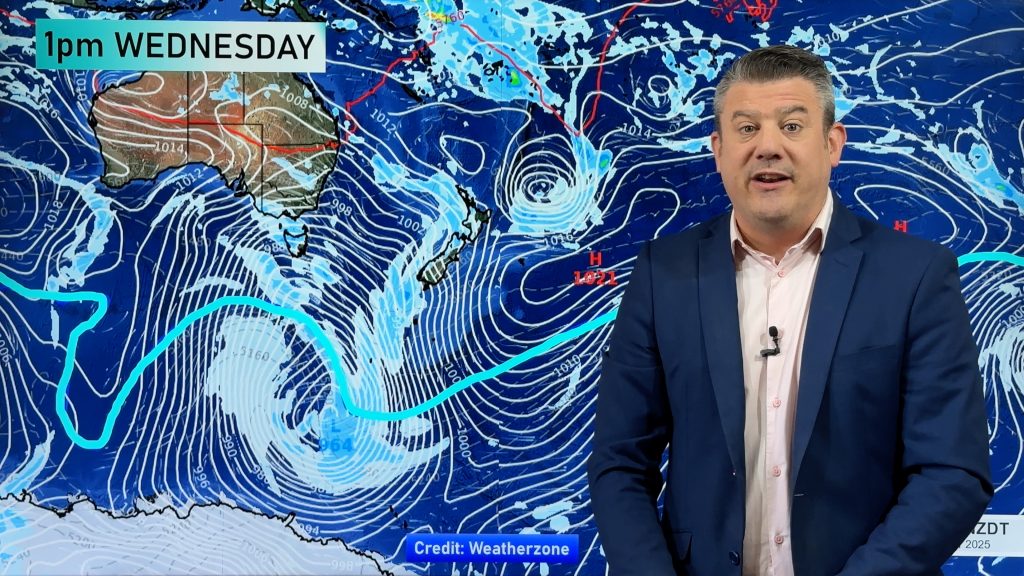
We’re not done with the Southern Ocean yet. A very large storm south of NZ next week will ensure a burst of windy westerlies, heavy West Coast rain and a sign that the energy south of NZ may continue on into early summer, despite the building La Nina conditions to NZ’s north.
This makes the weather pattern messier around New Zealand and while we do have high pressure coming in this weekend it’s going to be challenged next week by a sub-tropical low, a Tasman Sea low and a very large Southern Ocean low. Certainly busy weather maps.
Today (Friday) and this weekend is largely settled – but there will be some cloudy areas, isolated showers/downpours and isolated daytime/early evening thunderstorms possible. Large dry areas.
Next week there’s a brief cold change in the south of the South Island, then the week heats up as nor’westers build, potentially bringing temperatures into the upper 20s, even the lower 30s.
We have your 7 day forecast and 7 day rainfall outlook as a spring pattern continues.
*Programming Note: Not locked in yet, but it’s possible our Monday video may be published later on Monday afternoon.
Latest Video

Matariki, the long weekend + the outlook for next week
Wet weather and cloud continues along the eastern side of the country with the heaviest rain now moving into northern…
Related Articles
Matariki, the long weekend + the outlook for next week
Wet weather and cloud continues along the eastern side of the country with the heaviest rain now moving into northern…

More eastern rain, but a drier long weekend coming
Rain continues today along the eastern South Island and lower North Island, coming in from the east with heavy falls….

More heavy rain, snow – but large dry areas, especially as we go into the long weekend
Heavy rain will continue for parts of Canterbury and Marlborough over the next day or two and it will gradually…

