
> From the WeatherWatch archives
Spring really has chucked a cat amongst the pigeons with snow falling to quite low levels for this time of year about inland Canterbury.
We expected snow to fall about inland Canterbury today with an outlook on Wednesday saying that heavy snow could fall to 600m, then we lifted this to 700m on Thursday as it was what model information was indicating, the freezing levels lifted.
But why the difference? It’s fallen 300m or possibly even 400m below the 700m level. This is most likely caused by a process called evaporative cooling and it happens very infrequently, so infrequently that it could be 5 or 10 years between occurrences and when a new occurrence comes along it can be hard to see / remember the patterns forming and what the results may be. Years of experience would need to come to the fore here. Unfortunately it can catch the best of forecasters off guard as it has done today.
People about inland Canterbury would have noted the very heavy rain that preceded this snow last night and that’s a clue as to why this happened, here’s a write up on evaporative cooling:
https://www.weatheronline.co.uk/reports/philip-eden/Absorbing-latent-heat.htm
Model information has got better as the years have come along, noticably in regards to warm advective snow falls and that is in play today (cold air undercutting warm moist air) but why it fell much lower than indicated, not so much just yet.

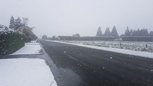

Images: Snow about inland Mid Canterbury today, Mt Somers. November 9th 2018
WeatherWatch.co.nz
Latest Video

Cold weekend, frosts return with high pressure, then a low late next week
The subantarctic airflow spreads over NZ today/tonight and into Saturday, dropping temperatures nationwide. Snow flurries are possible today to lower…
Related Articles
Cold weekend, frosts return with high pressure, then a low late next week
The subantarctic airflow spreads over NZ today/tonight and into Saturday, dropping temperatures nationwide. Snow flurries are possible today to lower…

Wintry burst of weather: Snow, squally showers then sunshine & frosts
A polar change (another one!) arrives on Friday for the South Island and goes nationwide on Saturday, leaving NZ under…

Antarctic southerly for parts of NZ Fri & Sat
For the first time this year a southerly from off Antarctica is heading towards the South Island, followed by more…

