Low pressure crosses NZ on Tuesday, high pressure for many this long weekend
1/02/2026 10:44pm
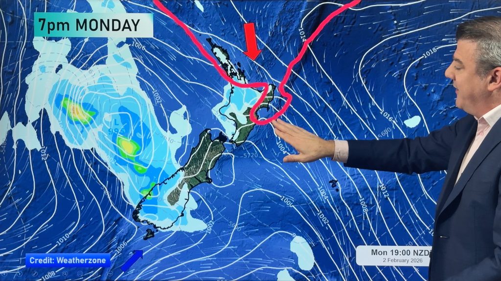
**Apologies for the visual problem in the first 5 seconds of the video**. Heat and humidity increases in northern NZ today and tonight, low pressure crosses the country on Tuesday and then a more refreshing southerly airflow will move in – all ahead of the next high pressure zone by Wednesday and Thursday.
Waitangi Day looks mostly settled around NZ, although some showers are likely in southern Westland, Fiordland and maybe Southland and Otago (although it won’t be much for most).
This weekend looks similar, although rain moves up the West Coast and on Sunday a cooler southerly with showers comes into Southland and Otago, while high pressure brings light winds and dry skies to much of the North Island, perhaps just a little windy through Cook Strait at times.
Latest Video

Rain & showers this weekend, colder change next week
Some places will warm up over the next day or so as a nor’wester out of Australia moves across NZ,…
Related Articles
Rain & showers this weekend, colder change next week
Some places will warm up over the next day or so as a nor’wester out of Australia moves across NZ,…

Temperature changes for some regions ahead of heavy West Coast rain
A nor-wester is about to kick in and it’s coming from out of Australia, boosting temperatures in some regions going…

NZ 7 day forecast: Showers, temp changes and heavy West Coast rain
NZ has a fairly messy forecast over the next 7 days, but the main feature will be heavy rain on…

