
> From the WeatherWatch archives
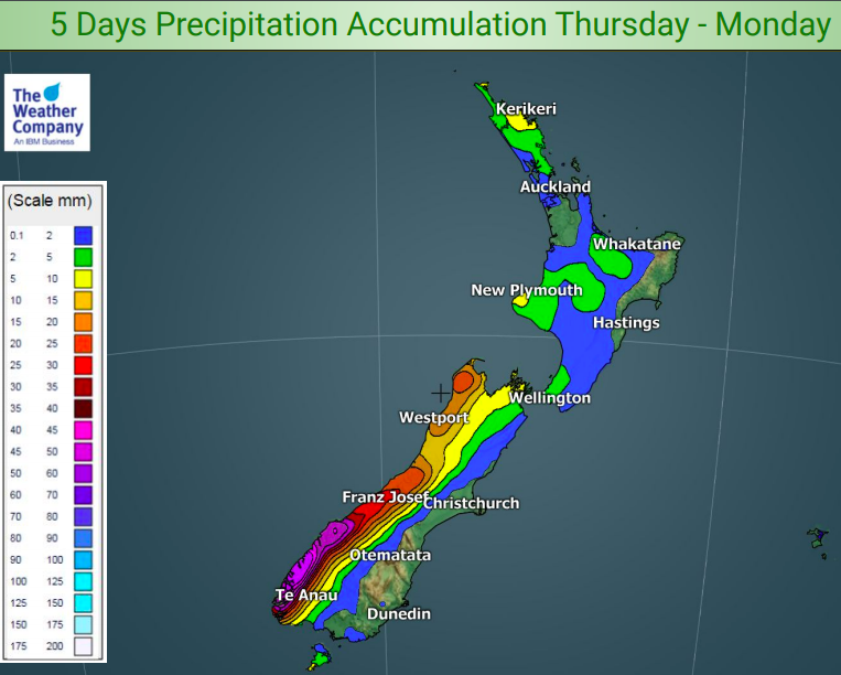
Most of the country is dry at the moment and while we may see some rain next week the next few days ahead still look mainly dry, except for the West Coast.
Totals vary but generally speaking the North Island and the entire eastern South Island looks either completely dry, or close to dry with just a few showers.
Rainfall totals on the West Coast are higher, generally 30 to 60mm over the next five days.
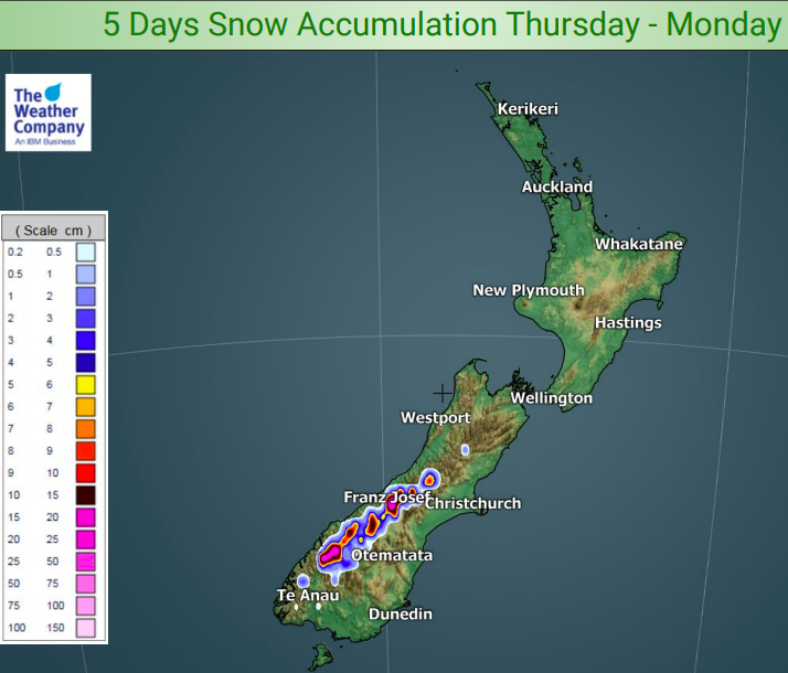
Snowfall amounts across the next five days are very poor with only 25cms on the mountain tops of the Southern Alps and very little elsewhere. This snow will be generated by the West Coast rain so will lean westwards. No snow – or significant snow – is currently forecast for Mt Ruapehu or the North Island mountians in the next five days, nor most of the central to eastern ranges of the South Island.
HEAVY RAIN NEXT WEEK?
Next week there is a chance for some heavy rain but it currently looks fairly isolated. The rain may be generated by a warm sub-tropical flow at the end of this big high currently moving in. Next Wednesday, Thursday and Friday NZ does have some chances of heavy rain coming in from the north and west. It’s not locked in but there is some chance so we’ll keep you updated. This rain would be welcome by many farmers and growers – because if it fails to arrive there is yet another big high coming in behind at the end of the first week of July promising another spell of dry, calm, weather.
– WeatherWatch.co.nz
Latest Video

Frosts, clearer skies coming – severe weather possible this weekend
High pressure lies south of NZ today and that placement encourages a colder south-east wind into the North Island bringing…
Related Articles
Frosts, clearer skies coming – severe weather possible this weekend
High pressure lies south of NZ today and that placement encourages a colder south-east wind into the North Island bringing…

NZ: 8 Day outlook as gales & rain ease, high pressure builds
Damaging wind gusts and heavy rain will continue to affect some parts of the North Island and brushing Marlborough today…

Pockets of hit & miss heavy rain, snow moves northwards
Low pressure continues to slowly move across the upper North Island and for some that will bring the sun out,…

