Much warmer than normal weather coming to NZ for end of November (+4 Maps)
20/11/2019 7:00pm

> From the WeatherWatch archives
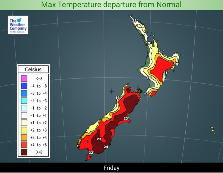
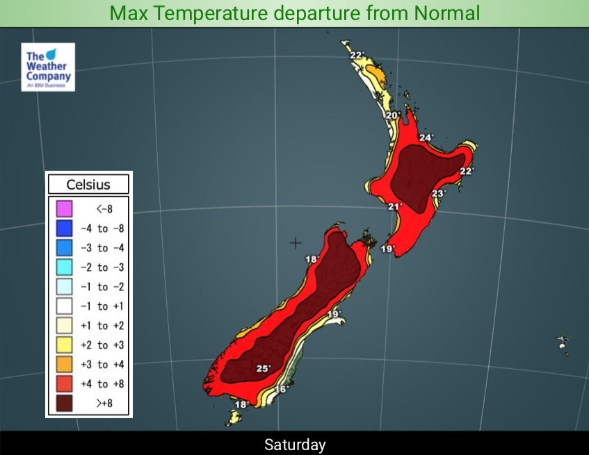
Hotter weather is coming to the country as nor’westers and sub-tropical airflows move in. Daytime highs will climb over 10 degrees above normal for some regions, especially inland and those learning to the east.
In fact remote inland areas of both islands will be pushing towards heatwave criteria with at least four days ahead with temperatures 5 degrees or move above normal. You need five days to technically be a ‘heatwave’.
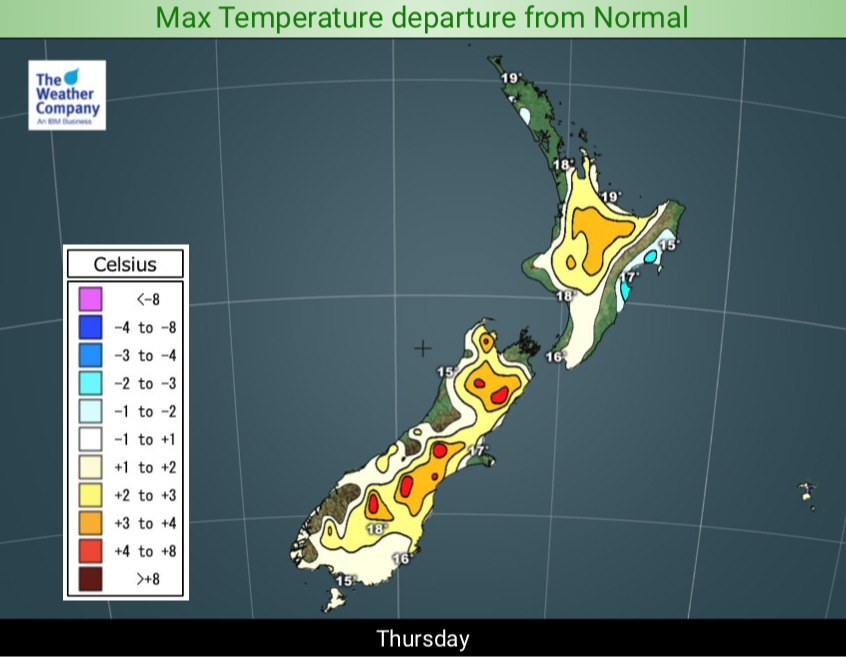
For today, Thursday, some places in the north will have daytime highs (late teens) similar to the overnight lows coming up (mid to late teens at times). However tonight is not one of those nights, so don’t be surprised if Thursday night and Friday morning are a little cool – especially around the North Island.
On top of the extended dry spell now moving in to 85% of the country the hotter than normal weather for late November will also add to the rapid drying out of farms and gardens and surface soil moisture.
Check your 10 day forecast or go to www.RuralWeather.co.nz (the world’s largest free weather data website for NZ) to see your local temperatures coming up. (Please note first time users it may take 10 seconds to load this site).
Some regions will have highs in the late 20s and possibly 30 either this weekend of next week at times. The wind flows mean temperatures will vary a little from day to day so check that local 10 day forecast for more info – or go to RuralWeather.co.nz.


– WeatherWatch.co.nz Exclusive
Latest Video

NZ: 8 Day outlook as gales & rain ease, high pressure builds
Damaging wind gusts and heavy rain will continue to affect some parts of the North Island and brushing Marlborough today…
Related Articles
NZ: 8 Day outlook as gales & rain ease, high pressure builds
Damaging wind gusts and heavy rain will continue to affect some parts of the North Island and brushing Marlborough today…

Pockets of hit & miss heavy rain, snow moves northwards
Low pressure continues to slowly move across the upper North Island and for some that will bring the sun out,…

Slow go for northern low & southern cold
For the next few days low pressure will crawl over the upper North Island, driving in rain as far south…

