More wintry weather coming – Some snow to low levels in southern NZ & Central North Island (+8 Maps)
4/07/2021 8:11pm
> From the WeatherWatch archives
Another wintry snap is on the way and while not as aggressive as last week’s polar blast it will bring snow into both islands and another temperature drop.
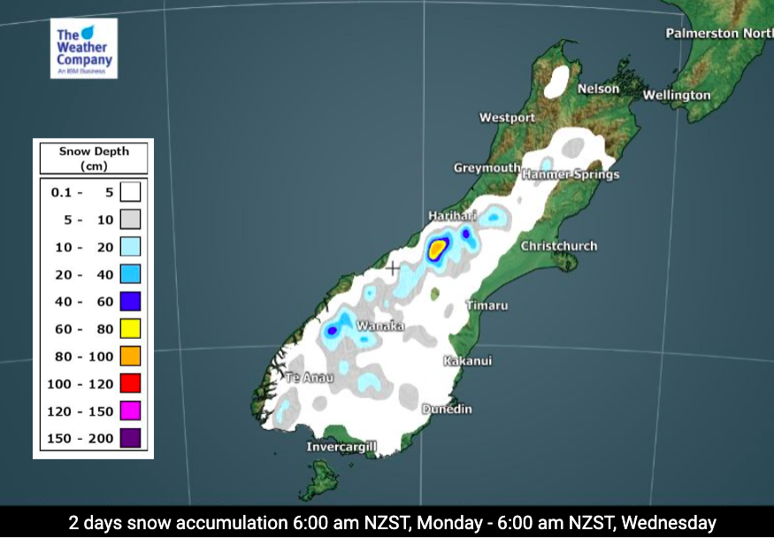
Warmer northerlies with sub-tropical connections will develop across New Zealand over Monday and Tuesday but by Tuesday evening a southerly (or south west) change will arrive from out of the Southern Ocean region and directly into southern NZ – and with it will come snow flurries to low levels (100 metres above sea level maybe).
Dunedin’s high on Wednesday is +5C, then +6C on Thursday and Friday with some snow flurries likely on the hill suburbs. Wind chill will again be below zero and with some parts of the South Island already in early lambing farmers should be prepared. Once again, cold air is the main feature and not heavy snow.
Snow flurries are possible in Gore, Lumsden, Balfour, Te Anau, Queenstown, around Alexandra, Arrowtown, Twizel, Tekapo and further north into Waiouru in the Central North Island and Desert Road. Accumulations may not be very high with some only getting a few flakes that don’t settle, but it’s an indicator of the colder air sweeping over NZ from late Tuesday to Friday.
Visit www.RuralWeather.co.nz for much more detail including windchill hourly for every single point across NZ – and of course our Maps and Radar section at WeatherWatch.co.nz.


Latest Video

More heavy rain, snow – but large dry areas, especially as we go into the long weekend
Heavy rain will continue for parts of Canterbury and Marlborough over the next day or two and it will gradually…
Related Articles
More heavy rain, snow – but large dry areas, especially as we go into the long weekend
Heavy rain will continue for parts of Canterbury and Marlborough over the next day or two and it will gradually…

Large low brings rain, downpours & some snow – gets colder as the week progresses
Low pressure will cross the upper North Island in the days ahead and that set-up actually pushes more heavy rain…

WeatherWatch App launches real-time local lightning tracker!
A bolt out of the blue! WeatherWatch has launched a live, real-time lightning tracker, enabling Kiwis to gain access to data provided by the…

