More wet weather in the days ahead, cooler for some, hotter for others (+4 Maps)
14/01/2019 8:35pm

> From the WeatherWatch archives
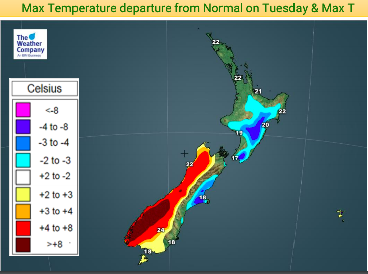
A southerly change on Monday means a number of regions, especially in the North Island, have a cooler than average day and night on the way again.
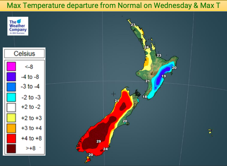
At the same time the South Island is warming back up to above average daytime highs with the exception of the east – it will take until Wednesday and Thursday for the North Island to warm back up again following Monday’s cool down.
With a small area of low pressure near Gisborne expect more areas of rain and showers in some North Island regions (mostly the very east) across Tuesday, easing Wednesday and clearing Thursday.
On Thursday another cold front will then reach Fiordland bringing showers, with heavy rain for the West Coast this coming weekend.


– WeatherWatch.co.nz
Latest Video

Cold weekend, frosts return with high pressure, then a low late next week
The subantarctic airflow spreads over NZ today/tonight and into Saturday, dropping temperatures nationwide. Snow flurries are possible today to lower…
Related Articles
Cold weekend, frosts return with high pressure, then a low late next week
The subantarctic airflow spreads over NZ today/tonight and into Saturday, dropping temperatures nationwide. Snow flurries are possible today to lower…

Wintry burst of weather: Snow, squally showers then sunshine & frosts
A polar change (another one!) arrives on Friday for the South Island and goes nationwide on Saturday, leaving NZ under…

Antarctic southerly for parts of NZ Fri & Sat
For the first time this year a southerly from off Antarctica is heading towards the South Island, followed by more…

