
> From the WeatherWatch archives
Mainly anticyclonic for New Zealand on Monday bringing settled conditions for most, a few morning drizzle patches then isolated showers about also.
North Island
Expect plenty of cloud for the North Island tomorrow, some sun now and then also especially afternoon along the east coast and in southwestern areas from Taranaki through to Wellington. There may be a light shower or two for the upper North Island, perhaps a few isolated heavy falls late afternoon / evening from southern Auckland through to Taupo. Winds are light for most tending onshore in the afternoon.
South Island
The South Island has mostly sunny conditions however about Southland and Otago skies are a bit cloudier, also some parts of the West Coast in the morning. It’s looking mainly dry, perhaps the risk of a shower about Fiordland. In the afternoon for inland areas cloud builds and isolated showers develop, especially inland Canterbury through to Central Otago where showers could become heavy before easing in the evening. Winds are light tending onshore in the afternoon.
Temperatures
Temperatures are looking to be in the low to mid twenties for most, highs in the mid twenties more likely for the North Island.
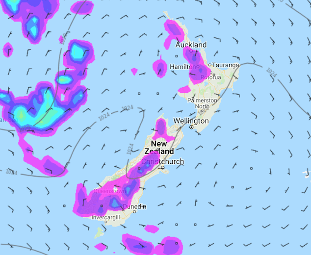
Image: Monday 18th March 2019 4:00pm MSLP / rain map – weathermap.co.nz
WeatherWatch.co.nz
Latest Video

Cold weekend, frosts return with high pressure, then a low late next week
The subantarctic airflow spreads over NZ today/tonight and into Saturday, dropping temperatures nationwide. Snow flurries are possible today to lower…
Related Articles
Cold weekend, frosts return with high pressure, then a low late next week
The subantarctic airflow spreads over NZ today/tonight and into Saturday, dropping temperatures nationwide. Snow flurries are possible today to lower…

Wintry burst of weather: Snow, squally showers then sunshine & frosts
A polar change (another one!) arrives on Friday for the South Island and goes nationwide on Saturday, leaving NZ under…

Antarctic southerly for parts of NZ Fri & Sat
For the first time this year a southerly from off Antarctica is heading towards the South Island, followed by more…

