Monday’s national forecast – High pressure expanding, heat rising (+7 Maps)
13/12/2020 3:00pm

> From the WeatherWatch archives
High pressure is moving in from the Tasman Sea and will dominate New Zealand for most of this week.
The anticyclone will bring hot weather to the South Island with temperatures jumping today (and going even higher on Tuesday).
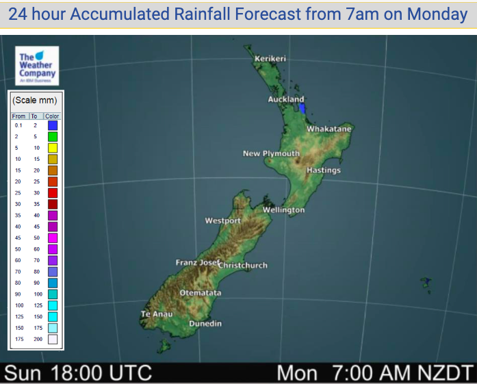
New Zealand looks entirely dry today – or perhaps one isolated light shower remaining in the fading southerly quarter flow.
To see how high temperatures will be getting in your part of NZ today, see the HOURLY details in your hyper-local WeatherWatch.co.nz forecast.


Latest Video

More eastern rain, but a drier long weekend coming
Rain continues today along the eastern South Island and lower North Island, coming in from the east with heavy falls….
Related Articles
More eastern rain, but a drier long weekend coming
Rain continues today along the eastern South Island and lower North Island, coming in from the east with heavy falls….

More heavy rain, snow – but large dry areas, especially as we go into the long weekend
Heavy rain will continue for parts of Canterbury and Marlborough over the next day or two and it will gradually…

Large low brings rain, downpours & some snow – gets colder as the week progresses
Low pressure will cross the upper North Island in the days ahead and that set-up actually pushes more heavy rain…

